place

Piscataway, Maryland

1706 establishments in MarylandHistoric districts in Prince George's County, MarylandHistoric districts on the National Register of Historic Places in MarylandNational Register of Historic Places in Prince George's County, MarylandPopulated places established in 1706
Unincorporated communities in MarylandUnincorporated communities in Prince George's County, MarylandWashington metropolitan area
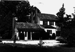
PISCATAWAY VILLAGE HISTORIC DISTRICT, PRINCE GEORGE'S COUNTY, MD

Piscataway is an unincorporated community in Prince George's County, Maryland, United States. It is one of the oldest European-colonized communities in the state. The Piscataway Creek provided sea transportation for export of tobacco. It is located near the prior Piscataway tribe village of Kittamaqundi.Piscataway was created in 1706 when the colonial Maryland Legislature authorized surveying and laying out the towns of Queen Anne Town, Nottingham, Mill Town, Piscataway, Aire (also known as Broad Creek) and Upper Marlboro (then known as Marlborough Town).In 1747, the legislature tried to improve the quality and the method of marketing tobacco, then the major crop of the area. It established a formal system of tobacco inspection and quality control. The town was home to one of seven state tobacco warehouses built in Prince George's County. A "Committee of Correspondence" plotted local actions for the American Revolution in Piscataway. One famous resident was William Marbury, involved in a famous early Supreme Court case.During Prohibition in the 1920s, the area was known for the production and sale of moonshine. Some of the product was moved by boat to other areas along the Chesapeake Bay. The creek is now silted in and no longer navigable. The St. Mary's Catholic Church, school, and cemetery are a prominent feature of the community. The complex includes the small 1904 church and a larger 1988 sanctuary. Its parish boundaries include portions of five separate postal towns/communities, giving it the largest territory of any parish in the Archdiocese of Washington. A number of historic houses still survive in the middle of the little town, including a former hotel/tavern, although the last business (the John Wood store) closed in the 1970s. A large development called "The Preserve" is partially opened and is eventually planned to have 1,100 single-family homes. A short bypass road recently opened around the community. The central part of the historic village, centered on a stretch of Floral Park Road, has been listed on the National Register of Historic Places. The poem "The Sot-Weed Factor," by Ebenezer Cooke, mentions details of life in Piscataway during the early colonial period. The same subject was the subject of a novel by the same name by John Barth.

Excerpt from the Wikipedia article Piscataway, Maryland (License: CC BY-SA 3.0, Authors, Images).

Piscataway, Maryland
Floral Park Road,

Geographical coordinates (GPS) Address Nearby Places
placeShow on map

Wikipedia: Piscataway, MarylandContinue reading on Wikipedia

Geographical coordinates (GPS)

Latitude Longitude
N 38.700555555556 ° E -76.972222222222 °
placeShow on map

Address

Floral Park Road 2010
20735
Maryland, United States
mapOpen on Google Maps

PISCATAWAY VILLAGE HISTORIC DISTRICT, PRINCE GEORGE'S COUNTY, MD
Share experience

Nearby Places

Harmony Hall (Fort Washington, Maryland)

Harmony Hall, located in Fort Washington, Maryland, is managed by the United States National Park Service as part of the National Capital Parks-East system. It has been a National Park Service site since 1966. Harmony Hall is a 2+1⁄2-story Georgian country house built of red brick during the eighteenth century. It is surrounded by 65 acres (26 ha) of land on Broad Creek, a Potomac River tributary.The house was built circa 1769 by Enoch Magruder. After his death, the estate was given to his daughter, Sarah and her husband, Col. William Lyles. The estate was originally called Battersea, but came to be called Harmony Hall some time after 1792, when it was rented to brothers John and Walter Dulaney Addison and their wives. The name "Harmony Hall" commemorates the two couples' harmonious coexistence. Harmony Hall was sold by the Lyles family in 1850. After passing through other owners, the manor was purchased in about 1892 by Robert Stein, his brother Richard, and brother-in-law Joseph Adler. The three had immigrated from Silesia, and engaged in truck farming nearby. They lost control of the manor house in 1929, selling it to Charles Collins, but continued to farm and operate a general store in the area.The home was extensively restored beginning in 1927 by Charles Wallace Collins (1879–1964), a lawyer, writer, and librarian who made his home in Harmony Hall and devoted himself to its restoration after he retired. Collins bequeathed the house to the National Park Service.Beginning in 1985, Frank Calhoun leased the mansion and lived there, investing more than $1 million into the house and its upkeep. After he fell behind on renovations in his early 60s, the Park Service asked Calhoun to leave in 1999. The property has been empty and in accelerating decline since then. Though the Park Service periodically sends in staff and enlists students to clean up the grounds, Harmony Hall competes with many other historic properties for attention and funding.The home has been listed on the National Register of Historic Places since 1980, at which time its condition was described as "excellent". As of January 2010, Harmony Hall is closed to the public.Harmony Hall is also the name given to a community center building, on adjacent property, owned by the Maryland-National Capital Park and Planning Commission and used as their southern area headquarters office. The center includes a fitness center and hosts concerts, stage plays, art exhibits, arts classes, scout meetings, and other cultural programs. The building was originally an elementary school.