place

Weymouth Back River Reservation

Hingham, MassachusettsParks in Norfolk County, MassachusettsParks in Plymouth County, MassachusettsState parks of MassachusettsWeymouth, Massachusetts
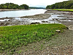
Stodders Neck, Weymouth Back River Reservation, Hingham MA

Weymouth Back River Reservation is a protected coastal reservation in Hingham and Weymouth, Massachusetts. It contains parks on the west and east sides of the northern end of Weymouth Back River. On the west side in Weymouth, Abigail Adams Park is adjacent to and north of Route 3A Bridge and Great Esker Park is south of the bridge. On the east side in Hingham, Stodder's Neck is north of the bridge and Bare Cove Park is south of the bridge. It features Weymouth Back River views, walking trails and landscaped areas.The reservation is part of the Metropolitan Park System of Greater Boston.

Excerpt from the Wikipedia article Weymouth Back River Reservation (License: CC BY-SA 3.0, Authors, Images).

Weymouth Back River Reservation
Lincoln Street,

Geographical coordinates (GPS) Address Nearby Places
placeShow on map

Wikipedia: Weymouth Back River ReservationContinue reading on Wikipedia

Geographical coordinates (GPS)

Latitude Longitude
N 42.248055555556 ° E -70.928611111111 °
placeShow on map

Address

Stodders Neck

Lincoln Street
02191
Massachusetts, United States
mapOpen on Google Maps

Stodders Neck, Weymouth Back River Reservation, Hingham MA
Share experience

Nearby Places

Grape Island (Massachusetts)

Grape Island is an island in the Hingham Bay area of the Boston Harbor Islands National Recreation Area. The island is part of the territory of the town of Weymouth, Massachusetts. The island has a permanent size of 54 acres (220,000 m2), plus an intertidal zone of a further 46 acres (190,000 m2), and is composed of two drumlins, reaching an elevation of 70 feet (21 m) above sea level, and connected by a marshy lowland. Tidal sand spits extend from the west end towards Weymouth Neck in Webb Memorial State Park and from the east end towards Slate Island. As a visitor attraction, Grape Island offers trails, rocky beaches, and camping in wooded campsites. At weekends and summer weekdays it is served by a shuttle boat to and from Georges Island, connecting there with ferries to Boston and Quincy.The island was farmed and grazed for three hundred years, until the 1940s. On the eve of the American Revolution, the island was owned by Hingham resident Elisha Leavitt, a Tory. In 1775, British troops raided the island during the siege of Boston, as Abigail Adams wrote to her husband John about May 24, 1775: "...it seems their Expidition (sic) was to Grape Island for Levets hay." A pitched battle ensued until the British were forced to retreat to the mainland. The angry colonists burned Leavitt's barn to the ground. In the end, very little damage was done to either side despite the effort expended. Three British soldiers may have been wounded (unconfirmed), no Continental soldiers or partisans were wounded, and less than two tons of hay were taken by the British.Since the abandonment of agricultural use in the 1940s, the natural succession of vegetation has created a wooded and shrubby landscape. Vegetation on the island includes early successional tree and shrub species on the drumlins, including staghorn sumac, gray birch, and quaking aspen. The island has an abundance of berries, including blackberry, dewberry, raspberry, blueberry, huckleberry, and American elderberry. The island's marshy lowland contains salt tolerant species such as saltspray rose, cordgrass, purple loosestrife, honeysuckle, and seaside goldenrod.Grape Island contains two freshwater springs. One spring is located on the north side of the western drumlin and is located underneath a large boulder that faces Peddock's Island. Another freshwater spring is located behind the marsh that is situated in the saddle between the two drumlins. Both of these areas are off the trail.

Slate Island
Slate Island

Slate Island is an uninhabited island of about 12.7 acres (5.1 ha) (at high tide) in Hingham Bay, an arm of Boston Harbor. It is part of Boston Harbor Islands National and State Park and is just east of Grape Island. The island mostly consists of slate outcrops partly covered with glacial till, and the shore is mostly rock. The highest elevation is 32 feet (9.8 m). The island was visited seasonally by Native Americans. In colonial times slate was quarried from the islands (the remnants of the quarry are still visible), mostly for house foundations. William Torey was given a grant for the island in 1650, with a stipulation that anyone was free to extract slate. Slate mining continued to a small degree into the 20th century and contributed to soil erosion on the rocky island. Later owners included Joseph Andrews, Samuel Lovell, Thomas Jones, and Caleb Loring. In the 17th century the island became part of the town of Hull (it is now in Weymouth). Around 1840 a hermit (his name lost to history) lived in a hut near the southern cove. (Moses Forster Sweetser opined that "his lonely hut must have made Thoreau's hermitage at Walden seem like Scollay Square after a theatre performance.") In the 1890s owner Edwin Clapp gave the island to the Clapp Memorial Association, which briefly hosted a summer camp there. Slate Island was privately owned until the 1970s when it became public property and part of the Boston Harbor Islands National and State Park. There are no trails, docks, or any other facilities on the island, which is overrun with vegetation including an abundance of poison ivy. The island is not serviced by the park ferry.