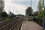
Pondersbridge
Pondersbridge is a village in Whittlesey civil parish, part of the Fenland district of Cambridgeshire, England. Pondersbridge is essentially a settlement which has built up around the river crossing, situated on an artificial drainage cutting called Bevill's Leam. The banks of Bevill's Leam form a strong visual boundary. The older settlement has been extended on the Main Road, north-wards by the local authority housing. The settlement has very limited services and a sporadic development pattern. The main part of Pondersbridge is contained within a triangle of roads - the B1040, the B1095 (from Stanground) and The Drove. The village has a population of just over 200 people and in 1990 had 46 houses, with planning permission for 19 more.The eponymous bridge over the Leam is a minor waterways place on the Middle Level Navigations between Bevill's Leam Pumping Station and Angle Corner.Situated on the B1040 road, the village is home to the Church of St. Thomas. St. Thomas' Church was built in 1869 to replace a previous church in the village.Ordnance Survey maps from the 1920s show an agricultural tramway running from Bevills' Leam to the north east of the village to Engine Farm then south west and south east across Glass Fen. There is a village hall which hosts community events and has a wall-mounted defibrillator on an external wall. There was once a pub called The Green Man, which was in existence in 1916.
Excerpt from the Wikipedia article Pondersbridge (License: CC BY-SA 3.0, Authors).Pondersbridge
Herne Road, Fenland District
Geographical coordinates (GPS) Address Nearby Places Show on map
Geographical coordinates (GPS)
| Latitude | Longitude |
|---|---|
| N 52.5118 ° | E -0.1432 ° |
Address
Herne Road
Herne Road
PE26 2TQ Fenland District
England, United Kingdom
Open on Google Maps


