Mount Frissell

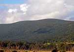
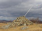
Mount Frissell, 2,454 feet (748 m), which straddles the border of southwest Massachusetts and northwest Connecticut, is part of the Taconic Range. Frissell's south slopes include the highest point in Connecticut. Frissell's summit and the majority of its slopes are within Massachusetts' Mount Washington State Forest. Its southern slopes are in Salisbury, Connecticut. Here the state line reaches to about 2,379 feet (725 m). The high-point marker for Connecticut is on the border with Massachusetts at 42.049633°N 73.483042°W / 42.049633; -73.483042. (The highest mountain summit in Connecticut is Bear Mountain, about 1.3 miles (2.1 km) to the east-southeast of Mount Frissell. Mount Frissell is traversed by the Mount Frissell Trail which connects with the South Taconic Trail to the west and the Appalachian Trail to the east. The south side of Mount Frissell drains into Riga Lake and South Pond, then into Wachocostinook Brook, Salmon Creek, the Housatonic River, and Long Island Sound. The northwest side drains into Ashley Hill Brook, thence Bash Bish Brook, the Roeliff Jansen Kill, the Hudson River, and Upper New York Bay. The northeast side drains into Sages Ravine, thence into Schenob Brook, the Hubbard Brook, the Housatonic River, and Long Island Sound. Mount Frissell is bordered by Round Mountain to the southeast, Mount Ashley to the north, and Brace Mountain to the west.
Excerpt from the Wikipedia article Mount Frissell (License: CC BY-SA 3.0, Authors, Images).Mount Frissell
Mount Frissell Trail, Town of North East
Geographical coordinates (GPS) Address Nearby Places Show on map
Geographical coordinates (GPS)
| Latitude | Longitude |
|---|---|
| N 42.051093558 ° | E -73.481977744 ° |
Address
Mount Frissell Trail
Mount Frissell Trail
Town of North East
Massachusetts, United States
Open on Google Maps


