place

University of California, Irvine Medical Center

Buildings and structures in Orange, CaliforniaEmergency services in Orange County, CaliforniaHospital buildings completed in 2009Hospitals established in 1965Hospitals in Orange County, California
Teaching hospitals in CaliforniaUniversity of California, Irvine buildings and structures
Ucirvinemedicalcenter

The University of California, Irvine Medical Center (UCIMC or UCI Medical Center) is a major research hospital located in Orange, California. It is the teaching hospital for the University of California, Irvine School of Medicine.

Excerpt from the Wikipedia article University of California, Irvine Medical Center (License: CC BY-SA 3.0, Authors, Images).

University of California, Irvine Medical Center
The City Drive South, Orange

Geographical coordinates (GPS) Address Phone number Website External links Nearby Places
placeShow on map

Wikipedia: University of California, Irvine Medical CenterContinue reading on Wikipedia

Geographical coordinates (GPS)

Latitude Longitude
N 33.78781 ° E -117.88857 °
placeShow on map

Address

UCI Medical Center

The City Drive South 101
92868 Orange
California, United States
mapOpen on Google Maps

Phone number
UC Irvine Health

call+17144567890

Website
ucirvinehealth.org

linkVisit website

linkWikiData (Q450401)
linkOpenStreetMap (170963630)

Ucirvinemedicalcenter
Share experience

Nearby Places

Angel Stadium
Angel Stadium

Angel Stadium of Anaheim, better known simply as Angel Stadium, is a baseball stadium located in Anaheim, California. Since its opening 57 years ago in 1966, it has served as the home ballpark of the Los Angeles Angels of Major League Baseball (MLB), and was also the home stadium to the Los Angeles Rams of the National Football League (NFL) from 1980 to 1994. The stadium is often referred to by its unofficial nickname The Big A, coined by Herald Examiner Sports Editor, Bud Furillo. It is the fourth-oldest active ballpark in the majors, behind Fenway Park, Wrigley Field, and Dodger Stadium, and hosted the All-Star Game in 1967, 1989, and 2010.ARTIC (Anaheim Regional Transportation Intermodal Center) servicing the Metrolink Orange County Line and Amtrak Pacific Surfliner, is located nearby on the other side of the State Route 57 and accessed through the Douglass Road gate at the northeast corner of the parking lot. The station provides convenient access to the stadium, the nearby Honda Center, and Disneyland from various communities along the route, which links San Luis Obispo, Los Angeles, and San Diego. The Anaheim Resort Transit stops at the center along with Orange County Transportation Authority buses. Aside from professional baseball and football, Angel Stadium has hosted high school and college football games, the short-lived World Football League, two crusades by Evangelist Billy Graham, nearly 20 consecutive annual crusades by Evangelist Greg Laurie, Eid el Fitr celebrations, and concerts, and 2 to 3 AMA Supercross Championship races a year. The stadium also houses the studios and offices of the Angels' owned and operated flagship radio station, KLAA (830 AM).

Area codes 714 and 657

Area codes 714 and 657 are telephone area codes covering northern Orange County, a portion of Los Angeles County, and the Sleepy Hollow and Carbon Canyon areas of Chino Hills in San Bernardino County in the U.S. state of California. Cities in the 657 and 714 area codes include Tustin, Placentia, Anaheim, Buena Park, Costa Mesa (unique because it is split between the 714/657 and 949 area codes, at Wilson Street and along Newport Boulevard), Cypress, Fountain Valley, Fullerton, Orange, Garden Grove, Santa Ana, Villa Park, Yorba Linda, portions of La Habra, and most of Brea and Huntington Beach. The original area code, 714, was split from area code 213 as a flash-cut in 1951. Originally, it included most of Southern California, generally south and east of Los Angeles, extending to the Arizona and Nevada state lines to the east, and south as far as the Mexican border (what is now area codes 442/760, 619, 858, 909, and 951). Despite Southern California's explosive growth in the second half of the 20th century, this configuration remained in place for 31 years. Finally, on January 1, 1982, most of the southern and eastern portion, centered around San Diego and the desert areas, became area code 619. In 1992, eastern Los Angeles and the Inland Empire became area code 909. On April 18, 1998, the southern cities of Orange County were split from 714, creating area code 949. By 2007, 714 was running out of numbers due to Southern California's continued growth and the proliferation of cell phones and pagers. As a solution, area code 657 was overlaid onto the 714 territory on September 23, 2008.The two area codes now cover northern and western Orange County (except for portions of La Habra and all of Seal Beach, Los Alamitos, the far northwestern portion of Brea, and the western portions of La Palma, which have always been in the same area code as Long Beach—currently the 562 area code). This is probably because at the time those splits first occurred, while most cities in Southern California were provided primary local telephone service from what was then Pacific Bell (now AT&T), the cities listed above were served by GTE, the primary telephone provider for Long Beach (this territory has since become part of Verizon, and now Frontier Communications). Today, five cities "straddle" the 657/714 and 949 area codes: Costa Mesa, Irvine, Santa Ana, Tustin, and Newport Beach.

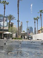
Santiago Creek
Santiago Creek

Santiago Creek is a major watercourse in Orange County in the U.S. state of California. About 34 miles (55 km) long, it drains most of the northern Santa Ana Mountains and is a tributary to the Santa Ana River. It is one of the longest watercourses entirely within the county. The creek shares its name with Santiago Peak, at 5,687 ft (1,733 m) the highest point in Orange County, on whose slopes its headwaters rise. The Santiago Creek watershed covers about 100.6 square miles (261 km2) in northern Orange County. The upper part of the creek is free-flowing, while the lower section is urbanized and includes parts of the cities of Tustin, Orange, and Santa Ana. Below the Villa Park Dam the creek is mostly channelized and flows only during heavy winter storms. Historically the Santiago Creek provided water for the Tongva people, whose territory extended over much of northern present-day Orange County and into the Los Angeles Basin. Native Americans have inhabited the Santiago Creek and Santa Ana River watershed for up to 12,000 years. The creek was named by the Spanish Gaspar de Portolá expedition of 1769, which crossed the Santa Ana River near where it meets the Santiago Creek. In the 1870s there was a short-lived silver boom along the tributary Silverado Creek. In 1929 the Santiago Dam was built to form Irvine Lake, to supply irrigation water. Pipelines from Irvine Lake still contribute a small amount of water to the municipality of Villa Park.