Little Bedwyn
Civil parishes in WiltshireEngvarB from August 2019Villages in Wiltshire

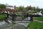
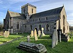
Little Bedwyn (also spelt Little Bedwin, and sometimes called Bedwyn Parva) is a village and civil parish on the River Dun in Wiltshire, England, about 3 miles (4.8 km) south-west of the market town of Hungerford in neighbouring Berkshire. The parish includes the hamlet of Chisbury. The Kennet and Avon Canal and the Reading to Taunton railway line follow the Dun and pass through the village. Little Bedwyn is served by Bedwyn railway station, which is about 1 mile (1.6 km) south-west of the village at Great Bedwyn.
Excerpt from the Wikipedia article Little Bedwyn (License: CC BY-SA 3.0, Authors, Images).Little Bedwyn
Kelston Road,
Geographical coordinates (GPS) Address Nearby Places Show on map
Geographical coordinates (GPS)
| Latitude | Longitude |
|---|---|
| N 51.391 ° | E -1.582 ° |
Address
Kelston Road
Kelston Road
SN8 3JP , Little Bedwyn
England, United Kingdom
Open on Google Maps


