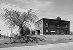
Allegheny Mountain (Pennsylvania)
Allegheny MountainsLandforms of Cambria County, PennsylvaniaLandforms of Somerset County, PennsylvaniaRidges of Bedford County, PennsylvaniaRidges of Pennsylvania

Allegheny Mountain is a stratigraphic ridge that extends northeast to southwest from south of Blue Knob to a saddle point at the Savage Mountain anticline. It merges with Negro Mountain just north of the Cambria County line where the Berlin-Salisbury basin expires.The Eastern Continental Divide enters Allegheny Mountain south of Fraziers Pass and follows the Allegheny Backbone southwest where it leaves the escarpment toward the saddle point to the southeast between headwaters of Flaugherty and Wills Creeks, at which the ECD enters the Savage Mountain anticline.: 9
Excerpt from the Wikipedia article Allegheny Mountain (Pennsylvania) (License: CC BY-SA 3.0, Authors, Images).Allegheny Mountain (Pennsylvania)
Bucktail Road, Juniata Township
Geographical coordinates (GPS) Address Nearby Places Show on map
Geographical coordinates (GPS)
| Latitude | Longitude |
|---|---|
| N 40.058055555556 ° | E -78.758055555556 ° |
Address
Bucktail Road
Bucktail Road
Juniata Township
Pennsylvania, United States
Open on Google Maps


