place

Slotlaan metro station

1994 establishments in the NetherlandsCapelle aan den IJsselEuropean rapid transit stubsNetherlands transport stubsRailway stations opened in 1994
Rotterdam MetroSouth Holland geography stubs
Mk Rotterdam Metro 5

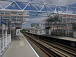
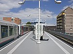
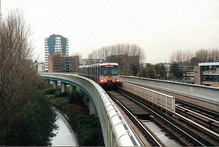
Slotlaan is an elevated station on Line C of the Rotterdam Metro and is situated in the town of Capelle aan den IJssel, just east of Rotterdam. The station was opened on 26 May 1994 as part of the extension of the East-West Line or Caland Line from Capelsebrug station towards De Terp station. The station consists of two tracks with a platform on both sides. Near the station is the Comenius College middle school from Capelle aan den IJssel.

Excerpt from the Wikipedia article Slotlaan metro station (License: CC BY-SA 3.0, Authors, Images).

Slotlaan metro station
Louis Couperusplaats,

Geographical coordinates (GPS) Address Nearby Places
placeShow on map

Wikipedia: Slotlaan metro stationContinue reading on Wikipedia

Geographical coordinates (GPS)

Latitude Longitude
N 51.928502777778 ° E 4.5784833333333 °
placeShow on map

Address

Slotlaan

Louis Couperusplaats
2902 XA
South Holland, Netherlands
mapOpen on Google Maps

Mk Rotterdam Metro 5
Share experience

Nearby Places

Stormvloedkering Hollandse IJssel

The Stormvloedkering Hollandse IJssel (English: Hollandse IJssel Storm Surge Barrier), Hollandse IJsselkering (Hollandse IJssel Barrier) or Algerakering (Algera Barrier) is a storm surge barrier located on the Hollandse IJssel, at the municipal boundary of Capelle aan den IJssel and Krimpen aan den IJssel, east of Rotterdam in The Netherlands. The construction of the works comprised the first project of the Delta Works, undertaken in response to the disastrous effects of the North Sea flood of 1953. Prior to 1954, the spelling Hollandsche was used in the official name. The Hollandse IJssel is a low-lying river, and during the 1953 flood, the river dikes were exposed to dangerously high water levels, placing around 1.5 million people in the Randstad at risk from flooding. A dike at Ouderkerk aan den IJssel failed, and a dike in Nieuwerkerk aan den IJssel was almost breached, being sealed only after the local mayor ordered sailor Arie Evegroen to navigate his barge Twee Gebroeders into the hole which had been formed in it. The body in charge of the Delta Works, the Deltacommissie, therefore prioritised the construction of a storm surge barrier, and in January 1954, less than a year after the flood, dredging works were undertaken to start the project.On May 6, 1958, the first sluice gate was lowered as a test, with the storm surge barrier made operational on 22 October 1958. The barrier is often referred to colloquially as the Algerakering, but has never been officially known by that name. The name arises as the adjacent bridge carrying the N210 road is officially named the Algerabrug (Algera Bridge), after Jacob Algera, who resigned as Minister of Transport and Water Management for health reasons on 10 October 1958, only twelve days before the opening of the project. The architect was J.A.G. van der Steur Jr., and the project was designed by the Deltadienst department of Rijkswaterstaat, with H.G. Kroon as construction engineer.The barrier is classified as a Rijksmonument. The four towers of the barrier are lit to act as aids to navigation, with blue lighting indicating an open barrier and red lighting indicating that the barrier is closed.