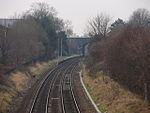
Pear Tree, Derby
Areas of DerbyEngvarB from October 2017

Pear Tree (or Peartree) is an inner city suburb of the city of Derby, in Derbyshire, England, located about 1.2 miles (1.9 km) south of the city centre. It is split between the Arboretum and Normanton electoral wards. Neighbouring areas include Litchurch, Normanton and Osmaston. The area became urbanised in the late 19th century and is characterised by terraced housing originally built for industrial workers.
Excerpt from the Wikipedia article Pear Tree, Derby (License: CC BY-SA 3.0, Authors, Images).Pear Tree, Derby
Pear Tree Crescent, Derby Peartree
Geographical coordinates (GPS) Address Nearby Places Show on map
Geographical coordinates (GPS)
| Latitude | Longitude |
|---|---|
| N 52.899972 ° | E -1.472082 ° |
Address
Pear Tree Crescent
DE23 8NT Derby, Peartree
England, United Kingdom
Open on Google Maps


