place

Martha's Vineyard Airport

1942 establishments in MassachusettsAirports established in 1942Airports in Dukes County, MassachusettsBuildings and structures in Tisbury, MassachusettsMartha's Vineyard
Pages with disabled graphs
MVY Logo site2 black 200

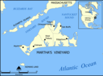
Martha's Vineyard Airport (IATA: MVY, ICAO: KMVY, FAA LID: MVY) is a public airport located in the middle of the island of Martha's Vineyard, three miles (5 km) south of the central business district of Vineyard Haven, in Dukes County, Massachusetts, United States. This airport is owned by Dukes County and lies on the border between the towns of West Tisbury and Edgartown.It is the largest of three airports and the only one on the island served by airlines. In addition to service from six commercial airlines, it is used by a significant number of general aviation aircraft. The other airports on the Island are Katama Airpark and Trade Wind Airport. The airport identifier MVY has entered into general use as an abbreviation for the island of Martha's Vineyard and is often used for non-aviation purposes.

Excerpt from the Wikipedia article Martha's Vineyard Airport (License: CC BY-SA 3.0, Authors, Images).

Martha's Vineyard Airport
Under Way,

Geographical coordinates (GPS) Address External links Nearby Places
placeShow on map

Wikipedia: Martha's Vineyard AirportContinue reading on Wikipedia

Geographical coordinates (GPS)

Latitude Longitude
N 41.393055555556 ° E -70.614444444444 °
placeShow on map

Address

Martha's Vineyard Airport

Under Way

Massachusetts, United States
mapOpen on Google Maps

linkWikiData (Q649760)
linkOpenStreetMap (117296178)

MVY Logo site2 black 200
Share experience

Nearby Places

Martha's Vineyard
Martha's Vineyard

Martha's Vineyard, often simply called the Vineyard, is an island in the Northeastern United States, south of Cape Cod in Dukes County, Massachusetts, known for being a popular, affluent summer colony. Martha's Vineyard includes the smaller adjacent Chappaquiddick Island, a peninsula, currently connected to the Vineyard. It is the 58th largest island in the U.S., with a land area of about 96 square miles (250 km2), and the third-largest on the East Coast, after Long Island and Mount Desert Island. Martha's Vineyard constitutes the bulk of Dukes County, which also includes the Elizabeth Islands and the island of Nomans Land. The island's year-round population has considerably increased since the 1960s. In the 2023 Martha’s Vineyard Commission report, the year-round population was 20,530, an increase from 16,460 in 2010. The summer population swells to more than 200,000 people. About 56 percent of the Vineyard's 14,621 homes are seasonally occupied.A study by the Martha's Vineyard Commission found that the cost of living on the island is 60 percent higher than the national average, and housing prices are 96 percent higher. A study of housing needs by the Commission found that the average weekly wage on Martha's Vineyard was "71 percent of the state average, the median home price was 54 percent above the state's and the median rent exceeded the state's by 17 percent," all leading to a stark example of severe income inequalities between year-round residents and their seasonal counterparts.