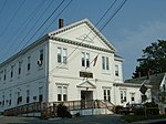
Taunton River Watershed

The Taunton River watershed or Taunton River basin is made up of 562 square miles (1,500 km2) of rivers, lakes, ponds, streams, and wetlands in southeastern Massachusetts, US. It is the second largest watershed in the state. Also, it is a significant part of a much larger multi-state watershed, the Narragansett Bay watershed. The Taunton River watershed is mostly situated in Bristol County and western Plymouth County, while some portions of it extends into parts of southern Norfolk County. The Taunton River watershed includes: 7 species of freshwater mussels 27 different habitat types 29 species of native fish 114 species of birds. 173 square miles (450 km2) of canoeable river 221 lakes and ponds Hockomock Swamp of 16,800 acres (6,800 ha)
Excerpt from the Wikipedia article Taunton River Watershed (License: CC BY-SA 3.0, Authors, Images).Taunton River Watershed
Milebrook Road,
Geographical coordinates (GPS) Address Nearby Places Show on map
Geographical coordinates (GPS)
| Latitude | Longitude |
|---|---|
| N 42 ° | E -71 ° |
Address
Milebrook Road 16
02379
Massachusetts, United States
Open on Google Maps


