Aldgate
AldgateLondon Wall and its gatesStreets in the City of LondonTown Gates in EnglandUse British English from November 2014 ... and 1 more
Wards of the City of London

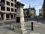
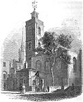
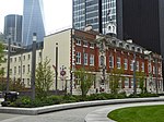
Aldgate () was a gate in the former defensive wall around the City of London. It gives its name to Aldgate High Street, the first stretch of the A11 road, which included the site of the former gate. The area of Aldgate, the most common use of the term, is focused around the former gate and the High Street and includes part of the city and parts of the London Borough of Tower Hamlets. It is 2.3 miles (3.7 km) east of Charing Cross. There is also an Aldgate Ward of the City of London. The Ward is of ancient origin, but intramural, so almost entirely distinct from the area around Aldgate High Street, which is mostly outside the line of the London Wall.
Excerpt from the Wikipedia article Aldgate (License: CC BY-SA 3.0, Authors, Images).Aldgate
Aldgate, City of London
Geographical coordinates (GPS) Address Nearby Places Show on map
Geographical coordinates (GPS)
| Latitude | Longitude |
|---|---|
| N 51.5132 ° | E -0.0777 ° |
Address
Aldgate 88-90
EC3M 4ST City of London
England, United Kingdom
Open on Google Maps


