Rive-de-Gier
Communes of Loire (department)Pages with French IPAPages with disabled graphs

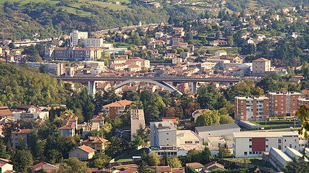
Rive-de-Gier (French pronunciation: [ʁiv də ʒje], literally Bank of Gier) is a commune in the Loire department in central France. In 2020, with a population of 15,086 inhabitants and an area of 7.3 km², the population density is 2,058 inhabitants per km² It was an important center of Loire coal mining basin, glass making and iron and steel manufacture in the 19th century. In the late 20th century the town lost most of its heavy industries.
Excerpt from the Wikipedia article Rive-de-Gier (License: CC BY-SA 3.0, Authors, Images).Rive-de-Gier
Rue Rochefolle, Saint-Étienne
Geographical coordinates (GPS) Address Nearby Places Show on map
Geographical coordinates (GPS)
| Latitude | Longitude |
|---|---|
| N 45.5303 ° | E 4.6178 ° |
Address
Rue Rochefolle
Rue Rochefolle
42800 Saint-Étienne
Auvergne-Rhône-Alpes, France
Open on Google Maps


