place

Jolimont (mountain)

Canton of Bern mountain stubsMountains of SwitzerlandMountains of Switzerland under 1000 metresMountains of the canton of Bern
Jolimont BE
Jolimont BE

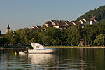
The Jolimont is a hill that stretches Southwest to Northeast for about 4 km along the Thielle canal, between the Lake of Neuchâtel and the Lake of Bienne, in the Seeland, Switzerland. The Jolimont elevation starts in Gampelen till Erlach (fr. Cerlier), where its promontory into the Lake of Bienne builds both the Isthmus and the St. Petersinsel peninsula. North, nestled between it and the Thielle canal lies Gals and, at its southern side, Tschugg.

Excerpt from the Wikipedia article Jolimont (mountain) (License: CC BY-SA 3.0, Authors, Images).

Jolimont (mountain)
Erlachweg,

Geographical coordinates (GPS) Address Nearby Places
placeShow on map

Wikipedia: Jolimont (mountain)Continue reading on Wikipedia

Geographical coordinates (GPS)

Latitude Longitude
N 47.025277777778 ° E 7.0613888888889 °
placeShow on map

Address

Fortification 14-18 Jolimont nord

Erlachweg
3238
Bern, Switzerland
mapOpen on Google Maps

Jolimont BE
Jolimont BE
Share experience

Nearby Places

Thielle
Thielle

The river Thielle (French: La Thielle, or La Thièle, German: Zihl), is a tributary to the Aare, in the Swiss Seeland. The Thielle results from the merging of the Orbe and Talent, northeast of the little city of Orbe in the Swiss canton of Vaud. It flows as a channel northeastwards through an intensively cultivated plain called "Plaine de l'Orbe" and flows after only 9 km into the Lake of Neuchâtel at Yverdon-les-Bains. The natural course of the river was considerably modified during the Jura water correction. Between the Lakes of Neuchâtel and Biel/Bienne it was converted into a dug-out channel. However, the previous natural bed of La Thielle still exists in some parts. The river flows out of the lake in Biel/Bienne and after 2 km merges directly into the Nidau-Büren channel, which was also dug out during the Jura water correction, ensuring the outflow of the Aare, just before the regulating dam in Port which was commissioned in 1939. Before, La Thielle used to flow into the Aare 7 km further downstream in the vicinity of Büren an der Aare. In the seventeenth century, a grand project was formed to establish a waterway transport system connecting the rivers Rhône and Rhine via the Lake of Geneva - the Venoge - and the Canal d’Entreroches - La Thielle - Aare. It unfortunately remained unfinished. A commercial waterway of this nature would have had a very significant impact on the European commercial transportation system.