place

Wargrave

Borough of WokinghamCivil parishes in BerkshirePopulated places on the River ThamesUse British English from October 2013Villages in Berkshire
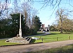
High Street, Wargrave, Berkshire geograph.org.uk 4679851

Wargrave () is a historic village and civil parish in Berkshire, England. The village is primarily on the River Thames but also along the confluence of the River Loddon and lies on the border with southern Oxfordshire. The village has many old listed buildings, two marinas with chandlery services for boats, a boating club and rises steeply to the northeast in the direction of Bowsey Hill, with higher parts of the village generally known as Upper Wargrave. In Upper Wargrave is a Recreation Ground with a cricket club, bowls club, football pitch and tennis club. Wargrave is situated in the A321 road 7 miles (11 km) from both Maidenhead and Reading and 3 miles (4.8 km) from Henley-on-Thames. The village is larger than the county average, having its own railway station on the Henley Branch Line, off the Great Western Main Line from London Paddington; the village is quickly accessible to nearby parts of the M4 corridor, particularly Berkshire and Heathrow Airport and local major centres of employment include Reading and Maidenhead, with smaller businesses and additional commercial facilities in nearby Henley-on-Thames and Wokingham.

Excerpt from the Wikipedia article Wargrave (License: CC BY-SA 3.0, Authors, Images).

Wargrave
Braybrooke Road,

Geographical coordinates (GPS) Address Nearby Places
placeShow on map

Wikipedia: WargraveContinue reading on Wikipedia

Geographical coordinates (GPS)

Latitude Longitude
N 51.499 ° E -0.867 °
placeShow on map

Address

Braybrooke Road

Braybrooke Road
RG10 8DX
England, United Kingdom
mapOpen on Google Maps

High Street, Wargrave, Berkshire geograph.org.uk 4679851
Share experience

Nearby Places

Shiplake railway station

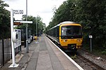
Shiplake railway station is a railway station in the village of Lower Shiplake (formerly Lashbrook) in Oxfordshire, England. The station is on the Henley-on-Thames branch line that links the towns of Henley-on-Thames and Twyford. It is 2 miles 60 chains (4.4 km) down the line from Twyford and 33 miles 61 chains (54.3 km) measured from London Paddington. It is served by local services operated by Great Western Railway.The station has a single platform, which is used by trains in both directions. There is a 50-space car park, but no station building other than a simple shelter. The station is unmanned, and tickets must be purchased on the train.The station was built in the village of Lashbrook in 1857, but named for the main village of Shiplake. The village of Shiplake, with the parish Church and grand manor houses of Shiplake Court and Shiplake House is actually over a mile away to the south of Shiplake Station. Victorian developers and their commuting commercial customers however then chose to build new houses close to the station, and the hamlet of Lashbrook grew rapidly and eventually changed its name to Lower Shiplake in the early twentieth century. In June 1914, it is said suffragettes were intending to burn Shiplake Church, but on realising it was such a distance from the station of the same name, burned Wargrave Church down instead. A camping coach was positioned here by the Western Region from 1956 to 1963.