place

Reading Stadium

1975 establishments in England2008 disestablishments in EnglandDefunct greyhound racing venues in the United KingdomDefunct speedway venues in EnglandDefunct sports venues in Berkshire
Demolished sports venues in the United KingdomSports venues completed in 1975Sports venues demolished in 2008Sports venues in Reading, BerkshireUse British English from October 2016
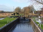
Reading Greyhound Stadium geograph.org.uk 8126

Reading Stadium also known as Smallmead Stadium was an English greyhound racing and speedway stadium in Bennet Road, Reading in the county of Berkshire. It is not to be confused with Reading Stadium on the Oxford Road that closed in 1974 and was located further to the north of Reading.

Excerpt from the Wikipedia article Reading Stadium (License: CC BY-SA 3.0, Authors, Images).

Reading Stadium
Island Road, Reading Whitley

Geographical coordinates (GPS) Address Nearby Places
placeShow on map

Wikipedia: Reading StadiumContinue reading on Wikipedia

Geographical coordinates (GPS)

Latitude Longitude
N 51.428333333333 ° E -0.9825 °
placeShow on map

Address

Reading Sewage Treatment Works

Island Road
RG2 0GH Reading, Whitley
England, United Kingdom
mapOpen on Google Maps

Reading Greyhound Stadium geograph.org.uk 8126
Share experience

Nearby Places

Coley (Reading ward)

Coley is an electoral ward of the Borough of Reading, in the English county of Berkshire. Until the 2022 Reading Borough Council election, it was known as Minster ward and had slightly different boundaries. It lies south-west of the town centre, comprising all or parts of the suburbs of Coley, Coley Park, and West Reading, together with a large tract of undeveloped River Kennet flood-plain to the south. From the south in clockwise order it is bounded by the River Kennet, the Reading to Basingstoke railway line, Reading West railway station, the Oxford Road, Prospect Street, Tilehust Road, Castle Hill, and the A33 back to the River Kennet. The ward is bordered, in the same order, by Whitley, Southcote, Battle, Abbey and Katesgrove wards. It lies entirely within the Reading West parliamentary constituency.The principal changes to the ward boundary in 2022 were the loss of the section of the old Minster ward to the west of the railway line, bounded by Bath Road, Parkside Road and Tilehurst Road, to Southcote ward, and the loss of the strip of Minster ward to the east of the A33, as far as the River Kennet, to Katesgrove ward. Coley ward also gained the area bounded by Tilehurst Road, Reading West station, Oxford Road and Prospect Street from Battle ward.As of 2016, there were just over 10,000 people living in Minster ward, of whom 21% were aged under 16, 12.6% were aged 65 and over, and 29% were born outside the UK. The population lived in a total of just under 4,700 dwellings, of which almost 50% were in purpose-built blocks of flats, and around 20% each were terraced houses or semi-detached houses, with detached houses and flat conversions making up the rest. Of the population aged between 16 and 74, approximately 70% were in employment and 5.5% were unemployed. Of those in employment, 50% were in managerial, professional or technical occupations, with 26% in professional occupations.As with all Reading wards, the ward elects three councillors to Reading Borough Council. Elections since 2004 are generally held by thirds, with elections in three years out of four, although the 2022 elections were for all councillors due to the boundary changes. The ward councillors are currently Ellie Emberson, Paul Gittings and Liz Terry, all of whom are members of the Labour party.

Berkshire
Berkshire

Berkshire ( (listen) BARK-shər, -⁠sheer; in the 17th century sometimes spelt phonetically as Barkeshire; abbreviated Berks.) is a historic county in South East England. One of the home counties, Berkshire was recognised by Queen Elizabeth II as the Royal County of Berkshire in 1957 because of the presence of Windsor Castle, and letters patent were issued in 1974. Berkshire is a county of historic origin, a ceremonial county and a non-metropolitan county without a county council. The county town is Reading. The River Thames formed the historic northern boundary, from Buscot in the west to Old Windsor in the east. The historic county, therefore, includes territory that is now administered by the Vale of White Horse and parts of South Oxfordshire in Oxfordshire, but excludes Caversham, Slough and five less populous settlements in the east of the Royal Borough of Windsor and Maidenhead. All the changes mentioned, apart from the change to Caversham, took place in 1974. The towns of Abingdon, Didcot, Faringdon, Wallingford and Wantage were transferred to Oxfordshire, the six places joining came from Buckinghamshire. Berkshire County Council was the main local government of most areas from 1889 to 1998 and was based in Reading, the county town which had its own County Borough administration (1888–1974). Since 1998, Berkshire has been governed by the six unitary authorities of Bracknell Forest, Reading, Slough, West Berkshire, Windsor and Maidenhead and Wokingham. The ceremonial county borders Oxfordshire to the north, Buckinghamshire to the northeast, Greater London to the east, Surrey to the southeast, Wiltshire to the west and Hampshire to the south. No part of the county is more than 8+1⁄2 mi (14 km) from the M4 motorway.

Southcote Junction
Southcote Junction

Southcote Junction is a railway junction in the English town of Reading. It is the point where the Reading to Basingstoke line diverges from the Reading to Taunton line, and is situated between the Reading suburbs of Southcote and Coley Park and some 2 kilometres (1.2 mi) to the south of Reading West station. A second adjacent junction, the Coley Branch Junction, formerly existed a few metres to the north where the Coley branch line diverged.The railway line from Reading to Hungerford (which would eventually become the Taunton line) opened on 21 December 1847, whilst the Basingstoke line opened on 1 November 1848. Both lines were proposed as part of the Berks and Hants Railway, but that company became part of the Great Western Railway before the track was laid. From 1908 until 1983, the Coley branch line diverged at Coley Branch Junction.Until 26 April 1965, the junction was controlled by Southcote Junction Signal Box, situated to the east of the line just north of the junction. A new signal box was opened here in 1896, to replace an earlier box, and it was upgraded in 1908 to cater for the new Coley branch. After closure the box was demolished, and control transferred to Reading Signal Box.The junction is readily visible from a footpath linking Wensley Road in Coley Park to Southcote Farm Lane in Southcote. This first crosses the trackbed of the old Coley branch, before running alongside the railway and then passing under both lines at the junction.Southcote Junction and the line between it and the junctions with the Great Western Main Line are heavily trafficked with a mixture of local passenger, long distance passenger and freight trains on both lines. In 2015, Network Rail’s Western Route Study suggested the provision of a grade separated junction at Southcote, with a third track to be provided between there and the Oxford Road Junction at Reading West.