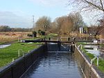
Foudry Brook

Foudry Brook is a small stream in southern England. It rises from a number of springs near the Hampshire village of Baughurst, and flows to the east and then the north, to join the River Kennet to the south of Reading. The upper section is called Silchester Brook, and beyond that, Bishop's Wood Stream. The underlying geology is chalk, covered by a layer of clay, and so it has the characteristics of a clay stream, experiencing rapid increases in level after heavy rain due to run-off from the surrounding land. It passes a number of listed buildings and scheduled monuments, including the site of the Roman town of Calleva Atrebatum or Silchester. The natural flow of the river is supplemented by treated effluent from two major sewage treatment works, which contribute to the poor quality of the water. Water quality is also affected by physical modification of the channel, which restricts the free movement of fish around the system.
Excerpt from the Wikipedia article Foudry Brook (License: CC BY-SA 3.0, Authors, Images).Foudry Brook
A33, Reading Whitley
Geographical coordinates (GPS) Address Nearby Places Show on map
Geographical coordinates (GPS)
| Latitude | Longitude |
|---|---|
| N 51.43511 ° | E -0.977381 ° |
Address
A33 Bridge
A33
RG2 0PR Reading, Whitley
England, United Kingdom
Open on Google Maps


