place

Fobney Lock

Berkshire building and structure stubsLocks of Reading, BerkshireLocks on the Kennet and Avon CanalUse British English from July 2017
Fobney Lock
Fobney Lock

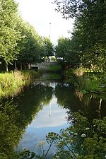
Fobney Lock is a lock on the River Kennet in the Small Mead area of Reading in the English county of Berkshire. Between the lock cut for the lock and the river itself is Fobney Island, which is a nature reserve.Fobney Lock was built between 1718 and 1723 under the supervision of the engineer John Hore of Newbury, and this stretch of the river is now administered by Canal & River Trust and known as the Kennet Navigation. It has a rise/fall of 7 ft 8 in (2.24 m).Fobney Island was transformed into a nature reserve in 2013, with the creation of wetland, a hay meadow and reed beds. It was intended that the resulting habitats would attract wildlife, including birds, bats, water voles, and otters.

Excerpt from the Wikipedia article Fobney Lock (License: CC BY-SA 3.0, Authors, Images).

Fobney Lock
Island Road, Reading Coley Park

Geographical coordinates (GPS) Address Website Nearby Places
placeShow on map

Wikipedia: Fobney LockContinue reading on Wikipedia

Geographical coordinates (GPS)

Latitude Longitude
N 51.43362 ° E -0.98722 °
placeShow on map

Address

Fobney Island Wetland Nature Reserve (Fobney Island Nature Reserve)

Island Road
RG2 0SF Reading, Coley Park
England, United Kingdom
mapOpen on Google Maps

Website
berksoc.org.uk

linkVisit website

Fobney Lock
Fobney Lock
Share experience

Nearby Places

Southcote Junction
Southcote Junction

Southcote Junction is a railway junction in the English town of Reading. It is the point where the Reading to Basingstoke line diverges from the Reading to Taunton line, and is situated between the Reading suburbs of Southcote and Coley Park and some 2 kilometres (1.2 mi) to the south of Reading West station. A second adjacent junction, the Coley Branch Junction, formerly existed a few metres to the north where the Coley branch line diverged.The railway line from Reading to Hungerford (which would eventually become the Taunton line) opened on 21 December 1847, whilst the Basingstoke line opened on 1 November 1848. Both lines were proposed as part of the Berks and Hants Railway, but that company became part of the Great Western Railway before the track was laid. From 1908 until 1983, the Coley branch line diverged at Coley Branch Junction.Until 26 April 1965, the junction was controlled by Southcote Junction Signal Box, situated to the east of the line just north of the junction. A new signal box was opened here in 1896, to replace an earlier box, and it was upgraded in 1908 to cater for the new Coley branch. After closure the box was demolished, and control transferred to Reading Signal Box.The junction is readily visible from a footpath linking Wensley Road in Coley Park to Southcote Farm Lane in Southcote. This first crosses the trackbed of the old Coley branch, before running alongside the railway and then passing under both lines at the junction.Southcote Junction and the line between it and the junctions with the Great Western Main Line are heavily trafficked with a mixture of local passenger, long distance passenger and freight trains on both lines. In 2015, Network Rail’s Western Route Study suggested the provision of a grade separated junction at Southcote, with a third track to be provided between there and the Oxford Road Junction at Reading West.

Courages Sports Ground

Courages Sports Ground was a sports and cricket ground in Coley Park suburb of the town of Reading, Berkshire, England. The ground belonged to the Courage Brewery in the town, and was principally provided for the sport and recreation of the brewery staff. It was located south of Berkeley Avenue, which is a part of the A4 road, and was bordered to the west by the Reading to Taunton railway and to the north, south and east by housing. Established prior to 1961, the first cricket match recorded at the ground is in 1964 when Courages Cricket Club played Calmore Sports. Berkshire first played at the ground in the 1975 Minor Counties Championship against Wiltshire. Berkshire played seven further Minor Counties Championship matches at the ground, the last of which came against Wiltshire in 1983. Two MCCA Knockout Trophy matches were played there in 1984 between Berkshire and Buckinghamshire. The first match ended in no result, with the second match won by Berkshire a replay. A single List A match was played there in the 1986 NatWest Trophy between Berkshire and Gloucestershire. Gloucestershire batted first and made 249/9 from their sixty overs, with Andy Stovold top scoring in the innings with 58, while Peter Lewington's 3/23 were the best bowling figures of the innings. Berkshire were dismissed for 129 to lose the match by 120 runs, with Mark Simmons' 26 the top score in Berkshire's innings, while David Lawrence took figures of 4/36. This was the last time Berkshire played at the ground, with the final recorded match to be played there coming in 1990.The ground was sold for residential development soon after the last game, with two roads on the new estate named after the cricketers Ken Barrington and Gordon Greenidge. A small southern portion of the ground wasn't built on and today forms the core of Courage Park.

Coley (Reading ward)

Coley is an electoral ward of the Borough of Reading, in the English county of Berkshire. Until the 2022 Reading Borough Council election, it was known as Minster ward and had slightly different boundaries. It lies south-west of the town centre, comprising all or parts of the suburbs of Coley, Coley Park, and West Reading, together with a large tract of undeveloped River Kennet flood-plain to the south. From the south in clockwise order it is bounded by the River Kennet, the Reading to Basingstoke railway line, Reading West railway station, the Oxford Road, Prospect Street, Tilehust Road, Castle Hill, and the A33 back to the River Kennet. The ward is bordered, in the same order, by Whitley, Southcote, Battle, Abbey and Katesgrove wards. It lies entirely within the Reading West parliamentary constituency.The principal changes to the ward boundary in 2022 were the loss of the section of the old Minster ward to the west of the railway line, bounded by Bath Road, Parkside Road and Tilehurst Road, to Southcote ward, and the loss of the strip of Minster ward to the east of the A33, as far as the River Kennet, to Katesgrove ward. Coley ward also gained the area bounded by Tilehurst Road, Reading West station, Oxford Road and Prospect Street from Battle ward.As of 2016, there were just over 10,000 people living in Minster ward, of whom 21% were aged under 16, 12.6% were aged 65 and over, and 29% were born outside the UK. The population lived in a total of just under 4,700 dwellings, of which almost 50% were in purpose-built blocks of flats, and around 20% each were terraced houses or semi-detached houses, with detached houses and flat conversions making up the rest. Of the population aged between 16 and 74, approximately 70% were in employment and 5.5% were unemployed. Of those in employment, 50% were in managerial, professional or technical occupations, with 26% in professional occupations.As with all Reading wards, the ward elects three councillors to Reading Borough Council. Elections since 2004 are generally held by thirds, with elections in three years out of four, although the 2022 elections were for all councillors due to the boundary changes. The ward councillors are currently Ellie Emberson, Paul Gittings and Liz Terry, all of whom are members of the Labour party.