place

Bertha (Perth)

Ancient Roman building and structure stubsHistory of Perth, ScotlandRoman auxiliary forts in ScotlandScheduled Ancient Monuments in Perth and KinrossScotland stubs
Use British English from December 2016

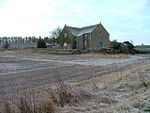
Bertha is the name of the site of a Roman fort north of the site of modern Perth, Scotland, at the confluence of the rivers Almond and Tay. It is 0.5 miles (0.80 km) east of the modern farm of "Berthapark" and is a scheduled ancient monument.The name "Bertha" was originally used by medieval Scots historians, such as John of Fordun and Walter Bower, who did not know the original name for the site and who adapted a version of Perth – "Berth". The Romans probably called the site Tamia, after a native name for the River Tay. In early medieval times the abandoned site was still used for ceremonial purposes by Pictish and Gaelic kings, when it was called "Rathinveramon".The fort was a supply base built around AD83 to support the occasional Roman expeditions into north-east Scotland. At that time, it was at the highest navigable point on the Tay. It is possible that the site was re-used on three occasions up to the 3rd century.The 9-acre (36,000 m2) site was identified in the 18th century. It has been damaged by river erosion and by ploughing, but excavations in 1973 revealed a ditch 11 feet (3.4 m) wide and 5.5 feet (1.7 m) deep. Immediately within the ditch was a wide berm over 30 feet (9.1 m) wide and this was backed by a turf rampart averaging about 21 feet (6.4 m) wide.

Excerpt from the Wikipedia article Bertha (Perth) (License: CC BY-SA 3.0, Authors).

Bertha (Perth)
A9, Perth Tulloch

Geographical coordinates (GPS) Address External links Nearby Places
placeShow on map

Wikipedia: Bertha (Perth)Continue reading on Wikipedia

Geographical coordinates (GPS)

Latitude Longitude
N 56.4248 ° E -3.4647 °
placeShow on map

Address

Bertha

A9
PH1 3XF Perth, Tulloch
Scotland, United Kingdom
mapOpen on Google Maps

linkWikiData (Q4895462)
linkOpenStreetMap (779188436)

Share experience

Nearby Places

Tulloch, Perth and Kinross

Tulloch, formerly known as Bleachfield, is a residential area of Perth, Scotland, approximately 1.5 miles (2.4 km) north-west of the centre of Perth. Tulloch is the western part of the area that borders Hillyland.The main access road to Tulloch, from the east or west, is Tulloch Road, reached via the Crieff Road (A85), which bounds it to the south. It is also accessible, albeit less directly, from the Dunkeld Road (A912), which bounds it to the north-east, via a modern housing development. It is bounded to the north-west by the A9. Tulloch has a small shopping precinct, Tulloch Square, located just off Tulloch Terrace. Tulloch Primary School, founded in 1969, is located on Gillespie Place. It can accommodate 400 pupils.Primrose Crescent, a main thoroughfare which, upon merging from Tulloch Road and Hillyland, circumnavigates Tulloch's oldest residential area before joining up with Tulloch Road again just before its western junction with Crieff Road. The skyline is dominated by several high-rise flats (one of which is in view in the background of the infobox image). In addition to the new housing development in the north-east of Tulloch/Hillyland, homes have also been built to the north and west. These are in addition to the first development (Sandeman Court) that went up in the 1980s in the valley behind the primary school, near the railway siding at the bottom of the hill. Between the housing and the railway siding is Perth Lade, which is sourced from Low's Work, a weir on the River Almond south of Almondbank, and empties 4.5 miles (7.2 km) away into the River Tay, near Smeaton's Bridge, via the city. A walking path runs parallel to the lade. Ladeside Court, a cul-de-sac off Fairfield Avenue, takes its name from the body of water. J. Pullar and Sons Ltd.'s Tulloch Works, a dry cleaning plant, once stood on the site of the present-day Bracken Brae. At the turn of the 20th century, architectural firm comprising John Honeyman, John Keppie and Charles Rennie Mackintosh designed a row of buildings for workers at the dyeworks. They were single-storey, semi-detached roughcast cottages. There were also two two-storey blocks containing a total of ten flats. The eight cottages remain, today's 61–75 Tulloch Terrace; the two flats have been demolished. Pullars also built Tulloch School, for their workers' children, in 1895. The school closed in 1911, and the building was later used by the Tulloch Institute.From certain parts of Tulloch, views are afforded of the hills beyond Scone to the east, including an obelisk on the 279-foot (85 m) summit of a hill near Muirend. To the north, the Grampian Mountains can be seen.