Marylebone
All pages needing cleanupAreas of LondonDistricts of the City of WestminsterEngvarB from February 2016Marylebone ... and 2 more
Places formerly in MiddlesexWikipedia introduction cleanup from October 2020

Marylebone (usually , also , ) is a district in the West End of London, in the City of Westminster. Oxford Street, Europe's busiest shopping street, forms its southern boundary. An ancient parish and latterly a metropolitan borough, it merged with the boroughs of Westminster and Paddington to form the new City of Westminster in 1965. Marylebone station lies two miles north-west of Charing Cross.
Excerpt from the Wikipedia article Marylebone (License: CC BY-SA 3.0, Authors, Images).Marylebone
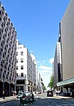
Harley Street, City of Westminster Marylebone
Geographical coordinates (GPS) Address Website Nearby Places Show on map
Geographical coordinates (GPS)
| Latitude | Longitude |
|---|---|
| N 51.5177 ° | E -0.147 ° |
Address
Harley Street Medical Centre
Harley Street 27
W1G 9QY City of Westminster, Marylebone
England, United Kingdom
Open on Google Maps


