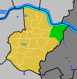
Slade Green
Areas of LondonDistricts of the London Borough of BexleyUse British English from September 2015

Slade Green is an area of South East London, England, within the London Borough of Bexley. It lies northeast of Bexleyheath, northwest of Dartford and south of Erith, and 14 miles (23 km) east-southeast of Charing Cross. Historically Slade Green was part of the county of Kent. In 1965 it became part of the new ceremonial county of Greater London.
Excerpt from the Wikipedia article Slade Green (License: CC BY-SA 3.0, Authors, Images).Slade Green
Whitehall Lane, London North End (London Borough of Bexley)
Geographical coordinates (GPS) Address Nearby Places Show on map
Geographical coordinates (GPS)
| Latitude | Longitude |
|---|---|
| N 51.468 ° | E 0.189 ° |
Address
Whitehall Lane / Slade Green Station
Whitehall Lane
DA8 2DJ London, North End (London Borough of Bexley)
England, United Kingdom
Open on Google Maps


