place

Ewelme

Civil parishes in OxfordshireSouth Oxfordshire DistrictVillages in Oxfordshire
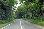
Ewelme geograph.org.uk 1082134

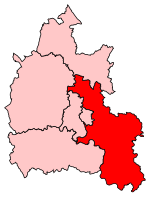
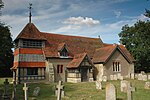
Ewelme () is a village and civil parish in the Chiltern Hills in South Oxfordshire, 2.5 miles (4 km) north-east of the market town of Wallingford. The 2011 census recorded the parish's population as 1,048. To the east of the village is Cow Common and to the west, Benson Airfield, the north-eastern corner of which is within the parish boundary. The solid geology is chalk overlying gault clay; the drift geology includes some gravel.

Excerpt from the Wikipedia article Ewelme (License: CC BY-SA 3.0, Authors, Images).

Ewelme
Parson's Lane, South Oxfordshire

Geographical coordinates (GPS) Address Nearby Places
placeShow on map

Wikipedia: EwelmeContinue reading on Wikipedia

Geographical coordinates (GPS)

Latitude Longitude
N 51.621 ° E -1.071 °
placeShow on map

Address

Parson's Lane

Parson's Lane
OX10 6HP South Oxfordshire
England, United Kingdom
mapOpen on Google Maps

Ewelme geograph.org.uk 1082134
Share experience

Nearby Places

RAF Benson
RAF Benson

Royal Air Force Benson or RAF Benson (IATA: BEX, ICAO: EGUB) is a Royal Air Force (RAF) station located at Benson, near Wallingford, in South Oxfordshire, England. It is a front-line station and home to the RAF's fleet of Westland Puma HC2 support helicopters, used primarily for the transportation of troops & equipment. Flying squadrons comprise No. 33 Squadron flying the Puma, No. 22 Squadron which provides operational evaluation and training for all aircraft in Joint Helicopter Command and No. 28 Squadron, which is the combined Puma and Boeing Chinook HC6A training unit. Other units include the Oxford University Air Squadron and No. 6 Air Experience Flight, both flying the Grob Tutor T1 light training aircraft used for student and cadet flying training. The National Police Air Service and the Thames Valley Air Ambulance are also based at the station, both operating Airbus H135 helicopters. RAF Benson opened in 1939 and during the Second World War it was tasked with training aircrews on the Fairey Battle light bomber and Avro Anson training aircraft. It was later home to squadrons flying the Supermarine Spitfire and de Havilland Mosquito which operated in the photographic reconnaissance role. Benson operated under RAF Transport Command throughout the 1950s and 1960s. During the 1970s, various communications and administrative units were present and in the early 1990s the station began its association with the support helicopter force.

A4074 road
A4074 road

The A4074 is a British A road from the Reading suburb of Caversham to the Heyford Hill roundabout on the Oxford Ring Road.The road starts from a junction with the A4155 close to the northern side of Caversham Bridge (over the River Thames) before climbing through the up-market residential area of Caversham Heights. Crossing the Reading Borough boundary, the road proceeds through the small community of Chazey Heath, where it enters thick woodland for several miles before emerging near the village of Woodcote. From here it crosses the more exposed ground of the Chiltern Hills before bypassing both Wallingford and Crowmarsh Gifford on the Wallingford bypass. It then passes by Benson, passes through Shillingford, bypasses Dorchester and passes through Nuneham Courtenay. The road becomes dual-carriageway as it passes Sandford-on-Thames and remains so to its terminus on the Oxford Ring Road at the Heyford Hill roundabout.The road was designated in the 1980s, when the B479 between Caversham and Crowmarsh Gifford was renumbered. In 1990 the A423 from Crowmarsh to Heyford Hill was renumbered the A4074, and the road became the primary route between Reading and Oxford in place of the A329 along the River Thames. The short stretch of the Oxford Ring Road between Heyford Hill and the Hinksey Hill interchange was not renumbered A4074, and remains an isolated fragment of the A423. The poor safety record of a particular stretch of this road, roughly between Chazey Heath and Woodcote, is highlighted in its local nickname, The 13 Bends of Death. Its accident rate of 53 per 100 million vehicle kilometres is nearly 70% higher than average for roads of its type.A half-hourly bus service, branded as river rapids and operated by Thames Travel, owned by Go-Ahead like its sister company the Oxford Bus Company, runs between Reading and Oxford along the A4074, albeit passing through the centre of Wallingford rather than using the by-pass. Alternate buses are numbered X39 and X40, with the X40 also diverting from the main road to serve Woodcote.