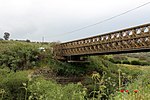
Mansurat al-Khayt
Arab villages depopulated during the 1948 Arab–Israeli WarDistrict of SafadPages with non-numeric formatnum arguments

See Mansura (disambiguation) for other sites with similar names.Mansurat al-Khayt was a Palestinian Arab village in the Safad Subdistrict. It was depopulated during the 1947–48 Civil War in Mandatory Palestine on January 18, 1948. It was located 11.5 km east of Safed, 1 km west of the Jordan River.
Excerpt from the Wikipedia article Mansurat al-Khayt (License: CC BY-SA 3.0, Authors, Images).Mansurat al-Khayt
Mountain Jordan road, Galil Elyon Regional Council
Geographical coordinates (GPS) Address Nearby Places Show on map
Geographical coordinates (GPS)
| Latitude | Longitude |
|---|---|
| N 32.970833333333 ° | E 35.616111111111 ° |
Address
מעיין הבוקרים
Mountain Jordan road
Galil Elyon Regional Council
North District, Israel
Open on Google Maps


