place

Gosberton Clough

South Holland, LincolnshireUse British English from February 2019Villages in Lincolnshire
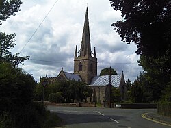
Church and schoolroom (geograph 4970470)

Gosberton Clough is a village in the civil parish of Gosberton and the South Holland district of Lincolnshire, England. It is 30 miles (50 km) south-east from the city and county town of Lincoln, 5 miles (8 km) north from the nearest large town of Spalding, and 3 miles (5 km) west-southwest from parish village of Gosberton.Gosberton Clough and the village Risegate to the east are conjoined as a 2 miles (3 km) linear settlement on the east to west B1397 road which runs along the south side of Risegate Eau (drain). Within Gosberton Clough the B1397 is named 'Clough Road', and in Risegate, 'Risegate Road', the villages separated at a bridge over the Risegate Eau at the junction with Chesboule Lane, running north, and Beach Lane, running south. The B1397 and the village is mirrored at the north of Risegate Eau by the parallel 'Siltside' (road). The Risegate Eau starts 2 miles (3 km) west at the South Forty-Foot Drain, then flows through the village, and reaches the River Welland at the Risegate Outfall sluice in Algarkirk Marsh, 7 miles (11 km) to the east. The north to south Hammond Beck intersects Risegate Eau at the west of the village, alongside of which is Beck Bank (road).Amenities, facilities and businesses include, on Clough Rd, Gosberton Clough & Risegate County Primary School (built in 1878 for 200 children), and a small business park with tyre sales and timber sales outlets, a transport company, and a warehousing facility. A further transport company for mini-buses, taxis and Light Haulage is at the west of the village. There is also the Parish Church of St Gilbert and St Hugh with its church hall. On Siltside are two village farms, a motorsports' shop, and, at the west end of Siltside where the road turns north to become Beck Bank, the Centenary Methodist Church.Gosberton Clough is connected by bus to Gosberton, Quadring and Spalding.In 1872 Gosberton Clough was described as containing a mission room, which was built in 1858 and enlarged in 1861. The only trade listed at the time was a blacksmith.

Excerpt from the Wikipedia article Gosberton Clough (License: CC BY-SA 3.0, Authors, Images).

Gosberton Clough
Clough Road, South Holland Gosberton CP

Geographical coordinates (GPS) Address Nearby Places
placeShow on map

Wikipedia: Gosberton CloughContinue reading on Wikipedia

Geographical coordinates (GPS)

Latitude Longitude
N 52.852 ° E -0.216583 °
placeShow on map

Address

Clough Road

Clough Road
PE11 4JW South Holland, Gosberton CP
England, United Kingdom
mapOpen on Google Maps

Church and schoolroom (geograph 4970470)
Share experience

Nearby Places

Westhorpe, Lincolnshire

Westhorpe is a hamlet in the civil parish of Gosberton and the South Holland district of Lincolnshire, England. It is 30 miles (50 km) south-east from the city and county town of Lincoln, 6 miles (10 km) north from the nearest large town of Spalding, and 1 mile (1.6 km) west from parish village of Gosberton.Westhorpe is a linear settlement on the east to west Westhorpe Road. It is centred on the junction of Westhorpe Road with Windmill Lane which runs to the village of Risegate 1,000 yards (900 m) to the south. Adjacent to the east of this junction is a road bridge over the north to south National Rail line from Lincoln to Peterborough. Westthorpe Road, which starts at Gosberton, runs 1500yds to the west from the Windmill Lane junction, where it becomes Swale Bank (road) at the junction with Quadring Bank (road) which runs north.Today, Westhorpe is a settlement of detached properties including new-build houses and bungalows. There is a creative craft company, a soft furnishings company, and four farms. In 1872 Westhorpe was a hamlet of Gosberton parish. There were twelve farmers, a beerhouse owner, a miller, a grocer & draper, and a "thrashing machine owner".There are four Grade II listed buildings in Westhorrpe. At the west from the Windmill Lane junction is Yew Tree Farmhouse, which dates to the 16th century. It had a front facade added in the late 17th century, and was altered in the early 19th and the 20th century. The farmhouse is a mixture of two storeys with three bays, and a single storey with attic, and is in red brick laid in Flemish bond with a pantile roof. At the east from the Windmill Lane junction is an early 19th-century two-storey three-bay house of Flemish bond red brick, with sash windows, slate roof and a "lattice porch". Further west is an early 18th-century cottage, with later alterations from the 19th and 20th centuries. It is of three bays with sash windows, and in rendered brick. The pantile roof has gable dormers and attics. Further west is a single storey mid-18th-century cottage with three bays and a corrugated iron roof with dormer windows.Westhorpe is connected by bus to Quadring and Spalding. The nearest school is Gosberton Academy primary school in Gosberton village.