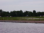
St. Mary's, Kawartha Lakes, Ontario
Communities in Kawartha LakesUse Canadian English from January 2023
St. Mary's was the site of a planned village within early Victoria County, in the Canadian province of Ontario. The site was laid aside in the surveying of the county in the 1830s, but was later found to be unusable when limestone was discovered two inches below the ground. Today its site marks one end of a man-made canal between Balsam Lake and Lake Simcoe, part of the Trent-Severn Waterway.
Excerpt from the Wikipedia article St. Mary's, Kawartha Lakes, Ontario (License: CC BY-SA 3.0, Authors).St. Mary's, Kawartha Lakes, Ontario
West Bay Boulevard, Kawartha Lakes
Geographical coordinates (GPS) Address Nearby Places Show on map
Geographical coordinates (GPS)
| Latitude | Longitude |
|---|---|
| N 44.576927777778 ° | E -78.894538888889 ° |
Address
West Bay Boulevard 206
Kawartha Lakes
Ontario, Canada
Open on Google Maps


