place

Woy Woy railway station

Central Coast Council (New South Wales)Easy Access railway stations in New South WalesMain North railway line, New South WalesRailway stations in Australia opened in 1889Regional railway stations in New South Wales
Transport on the Central Coast (New South Wales)
Woy Woy Railway Station

Woy Woy railway station is located on the Main Northern line in New South Wales, Australia. It serves the southern Central Coast suburb of Woy Woy opening on 1 February 1889.

Excerpt from the Wikipedia article Woy Woy railway station (License: CC BY-SA 3.0, Authors, Images).

Woy Woy railway station
Railway Street, Central Coast Council

Geographical coordinates (GPS) Address Nearby Places
placeShow on map

Wikipedia: Woy Woy railway stationContinue reading on Wikipedia

Geographical coordinates (GPS)

Latitude Longitude
N -33.48422 ° E 151.32423 °
placeShow on map

Address

Railway Street

Railway Street
2256 Central Coast Council
New South Wales, Australia
mapOpen on Google Maps

Woy Woy Railway Station
Share experience

Nearby Places

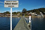
Saratoga, New South Wales

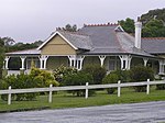
Saratoga is a residential south-eastern village and suburb of the Central Coast region of New South Wales, Australia, located on a peninsula of Brisbane Water and part of the Central Coast Council local government area. The suburb is characterised by its largely settled shoreline, with houses extending up coastal slopes to the base of the tall hills that comprise the core of the peninsula. The village of Saratoga occupies the central portion of its peninsula, bordered towards the point by Davistown and toward the mainland by Yattalunga. Initially utilised by indigenous peoples, the area of Saratoga was first exploited by European settlers for citrus orchards, after John Bourke and his family settled in the area in 1863. Bourke went on to become a pioneer in commercial citrus growing in the area of Brisbane Water. Sporadic building occurred thereafter, including the notable Federation-style house 'Rosemount', built in 1917 and surviving on 0.5 ha of land at the corner of Village Road and Brooklyn Road. In recent decades, housing development has transformed most of Saratoga into an outer residential suburb of Gosford. Bordered on three sides by water, Saratoga has also become a favourite haunt of fishermen and sports people. Most residents commute to Gosford, Kincumber or Erina for their daily needs, with few working in the suburb itself. Saratoga has a small shopping centre located on Village Road, which includes a petrol station, a general store, a fruit shop, a hairdresser, a newsagency, a liquor outlet, a real estate agency, a pharmacy, a takeaway shop,a bakery and a jeweller. Brisbania Public School [1] stands at the corner of High Street and Davistown Road. Saratoga is the home of the Saratoga Hawks, a Junior Australian Football Club established in 2001.