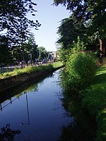
Lensfield Road

Lensfield Road is a road (part of the A603) in southeast central Cambridge, England. It runs between the junction of Trumpington Street and Trumpington Road to the west and the junction of Regent Street and Hills Road to the west. It continues as Gonville Place to the northeast past Parker's Piece, a large grassed area with footpaths.On the south side of the road are the Scott Polar Research Institute, St Alban's Primary School and the University of Cambridge's Yusuf Hamied Department of Chemistry. On the corner with Hills Road is Our Lady and the English Martyrs Church.To the north between Tennis Court Road and Regent Street is one of the larger University of Cambridge colleges, Downing College, which owns many properties on the road. This area used to be known as Pembroke Leys, a boggy area south of medieval Cambridge. Between Trumpington Street and Tennis Court Road to the north is the Old Addenbrooke's Site, where Addenbrooke's Hospital was located before it moved further out of Cambridge to the southeast at the end of Hills Road (on the edge of the city).
Excerpt from the Wikipedia article Lensfield Road (License: CC BY-SA 3.0, Authors, Images).Lensfield Road
Lensfield Road, Cambridge Petersfield
Geographical coordinates (GPS) Address External links Nearby Places Show on map
Geographical coordinates (GPS)
| Latitude | Longitude |
|---|---|
| N 52.19842 ° | E 0.12542 ° |
Address
Lensfield Road
Lensfield Road
CB2 1EG Cambridge, Petersfield
England, United Kingdom
Open on Google Maps


