place

Great Port of Saint Petersburg

Ports and harbours of RussiaTransport in Saint PetersburgWater transport in Russia

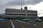
The Great Port of St. Petersburg or Port of St. Petersburg is a major seaport serving the city of St. Petersburg in northwest Russia. The port's water area is 164.6 km2 (630,000 square meters). The mooring line is 31 km long and the water is 25 metres (82 ft) deep at the port's deepest anchorages. Since 2011, the port has been under the authority of a state-owned enterprise (federal government agency), the Port Authority of the Great Port of St. Petersburg. This agency oversees commercial navigation in the seaport of St. Petersburg and beyond in the designated areas of responsibility of the Russian Federation.

Excerpt from the Wikipedia article Great Port of Saint Petersburg (License: CC BY-SA 3.0, Authors).

Great Port of Saint Petersburg
дорога в Угольную гавань, Saint Petersburg Ugolnaya Gavan (округ Автово)

Geographical coordinates (GPS) Address Phone number Website Nearby Places
placeShow on map

Wikipedia: Great Port of Saint PetersburgContinue reading on Wikipedia

Geographical coordinates (GPS)

Latitude Longitude
N 59.880555555556 ° E 30.199166666667 °
placeShow on map

Address

Первый Контейнерный Терминал причал 86

дорога в Угольную гавань 17
198096 Saint Petersburg, Ugolnaya Gavan (округ Автово)
Saint Petersburg, Russia
mapOpen on Google Maps

Phone number

call+78123357901

Website
fct.ru

linkVisit website

Share experience

Nearby Places

Ligovsky Pond
Ligovsky Pond

Ligovsky Pond (Russian: Лиговский пруд) was an artificial lake that existed in Ligovo, suburb of Saint Petersburg (Russia) from 1716–1941. In 1703, Peter I was based the city of Saint Petersburg. This area became a capital suburb. In 1710s emperor gook part in the destiny of the settlement. It was enjoined to block the Dudergofka river in 1715. On a dam a watermill which specialised on flour-grinding and felting works was constructed.Simultaneously the Ligovsky channel was built. It diverted an essential source of water from Dudergofka and its reservoir became a source of water for Ligovo. At that time the surrounding district represented imperial grange for palace maintenance with foodstuffs, including a dairy farm and gardens.In 1765 Grigory Orlov became the owner of the district. On the western coast of a pond were the house with landing stage and economic activity. On the east coast the manour house where Orlov accepted Russian empress Catherine II was constructed.After Orlov died in 1783, Ligovo was inherited by his pupil Natalia Alekseeva. She married Orlov's aide-de-camp Friedrich Wilhelm von Buxhoeveden. In the 1840s the manor of Buxhoeveden passed to count G. G. Kushelev-Bezbordko (younger), it continued useful agricultural activity, and Ligovo became an agricultural manor. A network of avenues and paths created specific hills and ponds were excavated. The house has a connected covered transition to kitchen. To the north were zones for an orchard with greenhouses, stables, the bird's and cattle courtyard. The lakeshore was improved by architect A. Stackenschneider. He added a terrace, a path from the house to lake, and a grotto on Love Island. After Kushelev-Bezbordko's death the manor gradually fell into decay. In 1857 the Baltic railway arrived. By the end of the 1870s vicinities Ligovsky pond became a holiday area. During the October Revolution in 1917 the lake, a dam and a mill were supported. After that the mill stopped. Waterfalls fell from the dam.The pond mirror was supported by a mill dam until 1941. On 5 December 1941 German armies destroyed the dam on the approach to Leningrad. After the Second World War hydraulic work was not restored. A ravine overgrown with bush became dominant. The former lake was not developed and became a memorial zone for the 700 men who died defending the area. Nearby an Orthodox church is under construction.