place

Fort York (neighbourhood)

AC with 0 elementsNeighbourhoods in Toronto
Fort York aerial
Fort York aerial

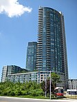
Fort York, also known as Garrison, is a neighbourhood in Toronto, Ontario, Canada, located west of Downtown Toronto, north of Billy Bishop Toronto City Airport, and east of Exhibition Place along the shores of Lake Ontario. While it is home to Fort York, a National Historic Site, it also contains several mid and high-rise condominium buildings built during the 21st century.

Excerpt from the Wikipedia article Fort York (neighbourhood) (License: CC BY-SA 3.0, Authors, Images).

Fort York (neighbourhood)
Fort York Boulevard, Toronto

Geographical coordinates (GPS) Address Website Nearby Places
placeShow on map

Wikipedia: Fort York (neighbourhood)Continue reading on Wikipedia

Geographical coordinates (GPS)

Latitude Longitude
N 43.639 ° E -79.405 °
placeShow on map

Address

Fort York

Fort York Boulevard 250
M5V 0C8 Toronto
Ontario, Canada
mapOpen on Google Maps

Website
fortyork.ca

linkVisit website

Fort York aerial
Fort York aerial
Share experience

Nearby Places

Fort York
Fort York

Fort York (French: Fort-York) is an early 19th-century military fortification in the Fort York neighbourhood of Toronto, Ontario, Canada. The fort was used to house members of the British and Canadian militaries, and to defend the entrance of the Toronto Harbour. The fort features stone-lined earthwork walls and eight historical buildings within them, including two blockhouses. The fort forms a part of Fort York National Historic Site, a 16.6-hectare (41-acre) site that includes the fort, Garrison Common, military cemeteries, and a visitor centre. The fort originated from a garrison established by John Graves Simcoe in 1793. Anglo-American tensions resulted in the fort to be further fortified, and designated as an official British Army post in 1798. The original fort was destroyed by American forces following the Battle of York in April 1813. Work to rebuild the fort began later in 1813 over the remains of the old fort, and was completed in 1815. The rebuilt fort served as a military hospital for the remainder of the War of 1812, although it briefly saw action against an American naval vessel in August 1814. After the war, the fort continued to see use by the British Army and the Canadian militia; even after newer fortifications were erected west of Fort York in the 1840s. In 1870, the property was formally transferred to the Canadian militia. The municipal government assumed ownership of the fort in 1909, although the Canadian military continued to make use of the fort until the end of the Second World War. The fort and the surrounding area was designated as a National Historic Site of Canada in 1923. The fort was restored to its early-19th century configuration in 1934, and reopened as a museum on the War of 1812 and military life in 19th century Canada.

Sir Isaac Brock Bridge

The Sir Isaac Brock Bridge is a steel Warren truss bridge in Toronto, Ontario, Canada. It lies along Bathurst Street over the railway tracks between Front Street and Fort York Boulevard. The bridge carries four lanes for motor vehicles with the centre lanes containing the streetcar tracks of the Toronto Transit Commission's 511 Bathurst streetcar route. The Bridge was formerly named The Bathurst Street Bridge before changing names and being named after Isaac Brock. The steel truss bridge was built in 1903 and used for the Great Western Railway over the Humber River (northside of then Lakeshore Road at mouth of the river). It was dis-assembled and re-located in 1916 to Bathurst Street and converted for road traffic. The bridge served to connect Bathurst Street at Front Street to Fort York.In 1931, the bridge was moved and re-aligned (Bathurst Street was at an angle south of Front Street) to support streetcar service south of the railway tracks at that location. A new bridge south of the bridge was constructed to connect the south end of the bridge, connecting Bathurst to Fleet Street. Fort York lost its road access in the change, and a footbridge to the east entrance was constructed.The Tywn River Drive Bridge, Queen Street Viaduct, and the Old Eastern Avenue Bridge are other examples of steel bridges in Toronto. Lawrence Avenue Bridge was a truss bridge that took traffic over Don River, but it was replaced by the current overpass over the Don River and Don Valley Parkway in the 1960s. In 2007, the bridge was given the official name of the "Sir Isaac Brock Bridge" by the City of Toronto. This was done at the instigation of the "Friends of Fort York" organization. The bridge is owned by Metrolinx, which owns the railway tracks below. It was formerly owned by the Canadian National Railway.From May until late-December 2020, the bridge was closed for rehabilitation work. Crews made steel and concrete repairs to the road-carrying spans and the exposed steel, replaced TTC streetcar tracks and overhead wiring, and constructed a new concrete parapet wall along the curb for improved safety.