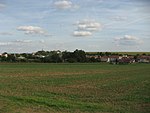
Brno-Slatina
BrnoNeighbourhoods in the Czech RepublicSouth Moravian Region geography stubs

Slatina is a city district of Brno, the second largest city in the Czech Republic. It is located in the eastern part of the city and is somewhat separated from other parts. Slatina became a part of Brno in 1919 and as of 2021, it has 11,104 inhabitants. Slatina has a well-preserved centre. The south of the district contains mostly modern houses, while the north of the district contains many panel houses built in the 1980s.
Excerpt from the Wikipedia article Brno-Slatina (License: CC BY-SA 3.0, Authors, Images).Brno-Slatina
Mikulčická, Brno Slatina
Geographical coordinates (GPS) Address Nearby Places Show on map
Geographical coordinates (GPS)
| Latitude | Longitude |
|---|---|
| N 49.178333333333 ° | E 16.684722222222 ° |
Address
Mikulčická
Mikulčická
627 00 Brno, Slatina
Czechia
Open on Google Maps


