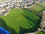
Dyke, Lincolnshire

Dyke is a village in the South Kesteven district of Lincolnshire, England. It is situated less than 1 mile (1.6 km) east from the A15 road, and approximately 1 mile north-east from Bourne. Dyke is within Bourne civil parish. The name Dyke arises from its lying on Car Dyke, a once much larger Roman ditch, which runs along the western edge of The Fens. The section of Car Dyke between Dyke and Bourne is a scheduled ancient monument.For population statistics Dyke, Twenty, South Fen, and Spalding road outside Bourne are taken together; Dyke is the largest of these settlements. The 2001 census recorded a population of 1,598, falling to 1,541 at the 2011 census.Dyke and Dyke Fen fall within the drainage area of the Black Sluice Internal Drainage Board.A new fountain was built on the green in the centre of the village to mark the millennium.Dyke's public house is The Wishing Well Inn.
Excerpt from the Wikipedia article Dyke, Lincolnshire (License: CC BY-SA 3.0, Authors, Images).Dyke, Lincolnshire
Redmile Close, South Kesteven Bourne
Geographical coordinates (GPS) Address Nearby Places Show on map
Geographical coordinates (GPS)
| Latitude | Longitude |
|---|---|
| N 52.78877 ° | E -0.36287 ° |
Address
Redmile Close
Redmile Close
PE10 0DA South Kesteven, Bourne
England, United Kingdom
Open on Google Maps


