Chollerton

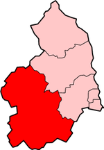
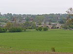
Chollerton is a village in Northumberland, England, on the A6079 road about six miles (10 km) to the north of Hexham, on the River North Tyne. Nearby villages include Low Brunton and Humshaugh. The village has a fine example of a mounting block standing at the churchyard gate. The church, built around the 12th century from local stone quarried from nearby, is dedicated to Saint Giles, and is noteworthy for the four large Roman columns built into its south aisle. These are believed to have been brought from the Roman fort of Chesters a couple of miles downstream. Chollerton is also a registration sub-district in Northumberland; its population in 1851 was 5024 people. The etymology of the name Chollerton is uncertain; possibly it is from the Old English "Ceolferth's tun" but more likely it meant "tun by Ceolan ford or Ceolford", if so "Ceolford" meant "Ceola's ford" (i.e. modern Chollerford).
Excerpt from the Wikipedia article Chollerton (License: CC BY-SA 3.0, Authors, Images).Chollerton
A6079,
Geographical coordinates (GPS) Address Nearby Places Show on map
Geographical coordinates (GPS)
| Latitude | Longitude |
|---|---|
| N 55.046 ° | E -2.103 ° |
Address
A6079
NE48 4DF
England, United Kingdom
Open on Google Maps


