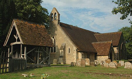
Toot Baldon
Civil parishes in OxfordshireOxfordshire geography stubsSouth Oxfordshire DistrictUse British English from August 2015Villages in Oxfordshire

Toot Baldon is a village and civil parish about 5 miles (8 km) southeast of Oxford in Oxfordshire. Since 2012 it has been part of the Baldons joint parish council area, sharing a parish council with the adjacent civil parish of Marsh Baldon. The 2011 Census recorded its population as 148.
Excerpt from the Wikipedia article Toot Baldon (License: CC BY-SA 3.0, Authors, Images).Toot Baldon
Baldon Lane, South Oxfordshire
Geographical coordinates (GPS) Address Nearby Places Show on map
Geographical coordinates (GPS)
| Latitude | Longitude |
|---|---|
| N 51.703 ° | E -1.18 ° |
Address
Baldon Lane
Baldon Lane
OX44 9NG South Oxfordshire
England, United Kingdom
Open on Google Maps


