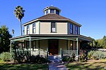
San Pasqual, Los Angeles County, California
Census-designated places in CaliforniaCensus-designated places in Los Angeles County, CaliforniaPages including recorded pronunciationsUse mdy dates from June 2023
San Pasqual () is a census-designated place in Los Angeles County, California. It lies between San Marino and Pasadena. The major streets in San Pasqual are San Pasqual Street, South Sierra Madre Blvd., and Oakdale Street. San Pasqual is served by the Pasadena post office responsible for ZIP code 91107, and thus locations there are properly addressed with the final line reading "Pasadena, CA 91107". The population was 2,041 at the 2010 census. The name comes from the Rancho San Pascual, of which San Pasqual is one of the remaining unincorporated areas.
Excerpt from the Wikipedia article San Pasqual, Los Angeles County, California (License: CC BY-SA 3.0, Authors).San Pasqual, Los Angeles County, California
South Roosevelt Avenue, Pasadena
Geographical coordinates (GPS) Address Nearby Places Show on map
Geographical coordinates (GPS)
| Latitude | Longitude |
|---|---|
| N 34.139166666667 ° | E -118.1025 ° |
Address
South Roosevelt Avenue 398
91107 Pasadena
California, United States
Open on Google Maps


