place

Tivetshall St Mary

Former civil parishes in NorfolkNorfolk geography stubsSouth NorfolkVillages in Norfolk
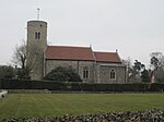
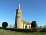
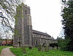
Tivetshall St. Mary church ruin 2 geograph.org.uk 741711

Tivetshall St Mary is a village and former civil parish, now in the parish of Tivetshall, in the South Norfolk district in the county of Norfolk, England. It covered an area of 4.65 km2 (1.80 sq mi) and had a population of 302 in 117 households at the 2001 census, the population falling to 298 at the census 2011. On the 1st of April 2019 the parish was merged with Tivetshall St Margaret to form Tivetshall.The villages name means 'Nook of land'. It has been suggested that the first element may be related to a late northern English dialectical, 'tewhit' meaning 'lapwing'. 'St. Mary' from the church dedication.

Excerpt from the Wikipedia article Tivetshall St Mary (License: CC BY-SA 3.0, Authors, Images).

Tivetshall St Mary
Gissing Road, South Norfolk Tivetshall

Geographical coordinates (GPS) Address Nearby Places
placeShow on map

Wikipedia: Tivetshall St MaryContinue reading on Wikipedia

Geographical coordinates (GPS)

Latitude Longitude
N 52.42872 ° E 1.18898 °
placeShow on map

Address

Gissing Road

Gissing Road
NR15 2DF South Norfolk, Tivetshall
England, United Kingdom
mapOpen on Google Maps

Tivetshall St. Mary church ruin 2 geograph.org.uk 741711
Share experience

Nearby Places

Pulham Market
Pulham Market

Pulham Market is a village and civil parish in Norfolk, situated approximately 8 miles (13 km) northeast of Diss and 14 miles (23 km) south of Norwich. It covers an area of 12.08 km2 (4.66 sq mi) and had a population of 999 in 443 households as of the 2001 census, the population falling to 977 at the 2011 Census.The name 'Pulham' means 'pool homestead/village' or 'pool hemmed-in land'. The nearest railway station is Diss. It once had its own station on the Waveney Valley Line which is now closed. The long-distance footpath Boudica's Way runs through the village. Older maps and documents name the parish or village "Pulham Saint Mary Magdalene" after the dedication of its parish church. The neighbouring parish and village was historically known as "Pulham Saint Mary the Virgin" after the dedication of its own parish church, though is these days typically abbreviated to Pulham St Mary. The earliest recorded spelling is Polleham. Pulham is referenced in the Domesday Book of 1086 as a single manor (including both Pulham Market and Pulham St Mary as we know them today) and being part of the Earsham hundred. The name Pulham is thought to mean the farmhouse, homestead or enclosure by the pool, water meadow or stream. There is a 'beck' (Norfolk dialect for a small watercourse) that flows by both villages. In modern times the two villages of Pulham St Mary and Pulham Market are often together described as The Pulhams including on road signs in the surrounding areas. The village was struck by an F0/T1 tornado on 23 November 1981, as part of the record-breaking nationwide tornado outbreak on that day. Another tornado later struck nearby Pulham St Mary. As of 2019, the village has a primary school, a doctors' surgery, two pubs (The Crown and The Falcon), a shop/post office, and several other community facilities.