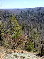
Natchaug State Forest
1917 establishments in ConnecticutAshford, ConnecticutChaplin, ConnecticutConnecticut state forestsEastford, Connecticut ... and 2 more
Parks in Windham County, ConnecticutProtected areas established in 1917

Natchaug State Forest is a Connecticut state forest located in six towns including Ashford, Chaplin, and Eastford. The Natchaug River runs from north to south along (and in a few cases through) the western border of the main forest parcel. James L. Goodwin State Forest abuts Natchaug State Forest to the south. One of the forest units abuts Mashamoquet Brook State Park in Pomfret.
Excerpt from the Wikipedia article Natchaug State Forest (License: CC BY-SA 3.0, Authors, Images).Natchaug State Forest
Perry Hill Road,
Geographical coordinates (GPS) Address Nearby Places Show on map
Geographical coordinates (GPS)
| Latitude | Longitude |
|---|---|
| N 41.879166666667 ° | E -72.187777777778 ° |
Address
Perry Hill Road 313
06278
Connecticut, United States
Open on Google Maps


