Prince William Forest Park

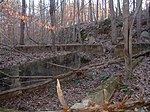
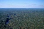
Prince William Forest Park is a national park in the U.S. state of Virginia within Prince William County (and very partially Stafford County), located adjacent to the Marine Corps Base Quantico near the town of Dumfries. Established as Chopawamsic Recreational Demonstration Area in 1936, the park is the largest protected natural area in the Washington, D.C. metropolitan region at over 13,000 acres (5,300 ha).The park serves as the largest example of Eastern Piedmont forest in the National Park System. The park also protects the Quantico Creek watershed. It is a sanctuary for numerous native plant and animal species. The park was developed by Works Progress Administration workers after the Great Depression. Landscaping and structures were designed by National Park Service architects. Four camp areas are listed individually on the National Register of Historic Places: Goodwill Historic District, Chopawamsic RDA Camp 1 Mawavi Historic District, Chopawamsic RDA Camp 2 Orenda/SP-26 Historic District, Chopawamsic RDA Camp 3 Pleasant Historic District, Chopawamsic RDA Camp 4The park also includes the Cabin Branch Pyrite Mine Historic District, listed on the National Register of Historic Places in 2002. The park itself was designed as the Prince William Forest Park Historic District in 2012.
Excerpt from the Wikipedia article Prince William Forest Park (License: CC BY-SA 3.0, Authors, Images).Prince William Forest Park
High Meadows Trail,
Geographical coordinates (GPS) Address Nearby Places Show on map
Geographical coordinates (GPS)
| Latitude | Longitude |
|---|---|
| N 38.585277777778 ° | E -77.379722222222 ° |
Address
High Meadows Trail
High Meadows Trail
22025
Virginia, United States
Open on Google Maps


