place

Warren Bridge

Bridges in BostonBridges over the Charles RiverFormer toll bridges in MassachusettsRoad bridges in Massachusetts
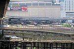
Warren Bridge, Boston (4016599215)

The Warren Bridge connected downtown Boston, Massachusetts with Charlestown from its construction in the 1820s until its demolition in 1962. It was replaced by the Charles River Dam in 1978. The Warren Bridge was requested in 1823 and chartered in 1828 by John Skinner and Isaac Warren, in response to the politically unpopular tolls on the 1786 Charles River Bridge. Its proprietors were authorized to collect tolls until they were reimbursed the cost of building the bridge and the other necessary expenses, with five per cent interest thereon, when the bridge was to revert to the Commonwealth. They were expressly limited from taking tolls for a longer period than six years. The bridge opened for travel on December 25, 1828. It connected Beverly Street in the North End of Boston to the then-independent city of Charlestown at City Square. The Charles River Bridge also terminated at City Square, with the Boston side at Charlestown Street (now North Washington Street, the site of the current Charlestown Bridge). This prompted a lawsuit, in which Daniel Webster served as attorney for the Charles River Bridge proprietors, which eventually reached the United States Supreme Court as Charles River Bridge v. Warren Bridge. The Commonwealth in 1833, assumed the control of the bridge, and tolls were received to its use until April, 1836, when the bridge was declared free. The Warren Bridge devolved to a state-owned, toll-free bridge on March 2, 1836. The receipts from tolls charged by the State on the Charles River Bridge and Warren Bridge, were sufficient to establish a fund of $850,000; and on the 1st December, 1843, the bridges were declared free, and so remained until June 1, 1854, when the income of the fund being found insufficient to sustain the bridges, and a large portion of the principal having been expended, tolls were again imposed on both bridges, to continue until a sufficient sum should be received to rebuild the Charles River Bridge, and repair the Warren Bridge, and to leave in the treasury of the Commonwealth a fund of $100,000 for the future maintenance and repair of the bridges. This was accomplished in 1858, and since April 30, 1858, both bridges were free.

Excerpt from the Wikipedia article Warren Bridge (License: CC BY-SA 3.0, Authors, Images).

Warren Bridge
North Washington Street, Boston West End

Geographical coordinates (GPS) Address Website Nearby Places
placeShow on map

Wikipedia: Warren BridgeContinue reading on Wikipedia

Geographical coordinates (GPS)

Latitude Longitude
N 42.368888888889 ° E -71.061666666667 °
placeShow on map

Address

The Charlestown Bells

North Washington Street
02222 Boston, West End
Massachusetts, United States
mapOpen on Google Maps

Website
paulmatisse.com

linkVisit website

Warren Bridge, Boston (4016599215)
Share experience

Nearby Places

Charlestown High Bridge

The Charlestown High Bridge (referred to as the John F. Fitzgerald Bridge on old AAA Tourbook maps) spanned the Charles River in Boston, Massachusetts and was part of I-93/US 1 at the north end of the Central Artery. This double-decked truss bridge, built in 1954, was to originally carry I-95 through Boston from southwest to northeast in tandem with the Tobin Bridge, built in 1950. The I-95 project and several other highway projects in and around Boston, including both the highly controversial Inner Belt (I-695) and the Southwest Corridor, completing the right-of-way intended to bring I-95 into Boston from Providence, Rhode Island, were cancelled due to heavy public opposition in the early 1970s. I-93 was allowed to be completed from the Yankee Division Highway (Route 128) to the foot of the Charlestown High Bridge in 1969, and the I-93 designation was extended onto the bridge and the Central Artery in the early 1970s. Originally intended to carry 75,000 vehicles per day in the 1950s, the Charlestown High Bridge carried upwards of 200,000 vehicles per day in the 1990s. For years, the bridge was a major traffic bottleneck that affected southbound commuters from Boston's North Shore and southern New Hampshire for miles. Travelling northbound, due to a poorly planned lane drop to accommodate incoming vehicles from Storrow Drive, traffic backups leading to the High Bridge threatened to cause hours of daily gridlock in downtown Boston. These problems were addressed in the planning and construction of the $14.6 billion Big Dig project. The cable-stayed Zakim Bunker Hill Bridge, which opened fully to traffic in December 2003, replaced the Charlestown High Bridge, which was demolished in 2004.

Leonard P. Zakim Bunker Hill Memorial Bridge

The Leonard P. Zakim () Bunker Hill Memorial Bridge (also known as the "Lenny" or “The Zakim”) is a cable-stayed bridge completed in 2003 across the Charles River in Boston, Massachusetts. It is a replacement for the Charlestown High Bridge, an older truss bridge constructed in the 1950s. Of ten lanes, using the harp-style system of nearly-parallel cable layout, coupled with the use of "cradles" through each pylon for the cables, the main portion of the Zakim Bridge carries four lanes each way (northbound and southbound) of the Interstate 93 and U.S. Route 1 concurrency between the Thomas P. "Tip" O'Neill Jr. Tunnel and the elevated highway to the north. Two additional lanes are cantilevered outside the cables, which carry northbound traffic from the Sumner Tunnel and North End on-ramp. These lanes merge with the main highway north of the bridge. I-93 heads toward New Hampshire as the "Northern Expressway", and US 1 splits from the Interstate and travels northeast toward Massachusetts' North Shore communities, crossing the Mystic River via the Tobin Bridge. The bridge and connecting tunnel were built as part of the Big Dig, the largest highway construction project in the United States. The northbound lanes were finished in March 2003, and the southbound lanes in December. The bridge's unique styling quickly became an icon for Boston, often featured in the backdrop of national news channels, to establish location, and included on tourist souvenirs. The bridge is commonly referred to as the "Zakim Bridge" or "Bunker Hill Bridge" by residents of nearby Charlestown. Notwithstanding, Boston sports fans also refer to the bridge as the "Bill Buckner Bridge" after Red Sox fielder Willam Buckner, since like Buckner's famous mishap, traffic goes between the legs of the bridge. The nickname takes on significance as Boston sports fans came to fondly embrace Buckner after many years.The Leverett Circle Connector Bridge was constructed in conjunction with the Zakim Bridge, allowing some traffic to bypass it.