place

City Square Park

Charlestown, BostonMassachusetts stubsParks in Boston
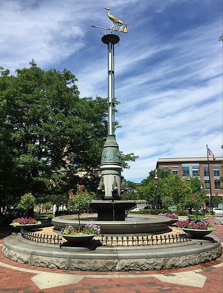
City Square fountain

City Square Park is a park in Boston's Charlestown neighborhood, in the U.S. state of Massachusetts.The park has a World War II Memorial.

Excerpt from the Wikipedia article City Square Park (License: CC BY-SA 3.0, Authors, Images).

City Square Park
US 1, Boston Charlestown

Geographical coordinates (GPS) Address Nearby Places
placeShow on map

Wikipedia: City Square ParkContinue reading on Wikipedia

Geographical coordinates (GPS)

Latitude Longitude
N 42.3717 ° E -71.0619 °
placeShow on map

Address

US 1
02222 Boston, Charlestown
Massachusetts, United States
mapOpen on Google Maps

City Square fountain
Share experience

Nearby Places

Town Hill District
Town Hill District

The Town Hill District is a historic district bounded roughly by Rutherford Avenue and Main and Warren Streets in the Charlestown neighborhood of Boston, Massachusetts. Town Hill was laid out by Charlestown engineer Thomas Graves in 1629 and was the site of Boston's first settlement. The unique elliptical street plan forms a tightly delineated neighborhood that survives to this day, one of the few colonial aspects to have survived. City Square (then known as Market Square) is the focus of the neighborhood, historically having been a market as well as the seat of government.During the 18th century, Market Square was paved and other important town institutions, including a courthouse and meeting-house, were built in the district. On April 18, 1775, Paul Revere, on the night of his famous ride, rowed to Charlestown from Boston. Here, he borrowed a horse and departed to sound his warning of British troops on the march all the way to Lexington and Concord. Town Hill is composed of residential and commercial structures dating from as early as 1780, when Charlestown was burned to the ground by the British during the Battle of Bunker Hill in 1775. Rebuilt after the revolution, the square, then known as Charlestown Square, regained its role as the center of town life. As the 19th century progressed, the square became a crossroads as bridges and grand hotels were built and wharves crowded the waterfront. Most of the buildings are constructed of natural materials including brick, wood, and stone.The district was added to the National Register of Historic Places in 1973. This district is currently under study for landmark status by the Boston Landmarks Commission.
Charlestown High Bridge

The Charlestown High Bridge (referred to as the John F. Fitzgerald Bridge on old AAA Tourbook maps) spanned the Charles River in Boston, Massachusetts and was part of I-93/US 1 at the north end of the Central Artery. This double-decked truss bridge, built in 1954, was to originally carry I-95 through Boston from southwest to northeast in tandem with the Tobin Bridge, built in 1950. The I-95 project and several other highway projects in and around Boston, including both the highly controversial Inner Belt (I-695) and the Southwest Corridor, completing the right-of-way intended to bring I-95 into Boston from Providence, Rhode Island, were cancelled due to heavy public opposition in the early 1970s. I-93 was allowed to be completed from the Yankee Division Highway (Route 128) to the foot of the Charlestown High Bridge in 1969, and the I-93 designation was extended onto the bridge and the Central Artery in the early 1970s. Originally intended to carry 75,000 vehicles per day in the 1950s, the Charlestown High Bridge carried upwards of 200,000 vehicles per day in the 1990s. For years, the bridge was a major traffic bottleneck that affected southbound commuters from Boston's North Shore and southern New Hampshire for miles. Travelling northbound, due to a poorly planned lane drop to accommodate incoming vehicles from Storrow Drive, traffic backups leading to the High Bridge threatened to cause hours of daily gridlock in downtown Boston. These problems were addressed in the planning and construction of the $14.6 billion Big Dig project. The cable-stayed Zakim Bunker Hill Bridge, which opened fully to traffic in December 2003, replaced the Charlestown High Bridge, which was demolished in 2004.