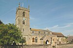
Wendlebury
Cherwell DistrictCivil parishes in OxfordshireUse British English from August 2015Villages in Oxfordshire

Wendlebury is a village and civil parish about 2 miles (3 km) southwest of Bicester and about 1⁄2 mile (800 m) from Junction 9 of the M40. Junction 9 is where the A34 and A41 roads meet the M40, and it is also called the Wendlebury Interchange.A stream flows through the centre of the village, parallel with the main street. The 2011 census recorded the parish's population as 421.The toponym is derived from Old English, meaning the burh of a Saxon named Wændel.
Excerpt from the Wikipedia article Wendlebury (License: CC BY-SA 3.0, Authors, Images).Wendlebury
St Giles Close, Cherwell District Wendlebury
Geographical coordinates (GPS) Address Nearby Places Show on map
Geographical coordinates (GPS)
| Latitude | Longitude |
|---|---|
| N 51.872 ° | E -1.187 ° |
Address
St Giles Close
St Giles Close
OX25 2PZ Cherwell District, Wendlebury
England, United Kingdom
Open on Google Maps


