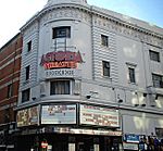
St Giles Circus
Execution sites in EnglandOdonyms referring to religionSt Giles, LondonStreets in the City of WestminsterStreets in the London Borough of Camden ... and 1 more
Use British English from June 2015

St Giles Circus is a road junction in the St Giles district of the West End of London at the eastern end of Oxford Street, where it connects with New Oxford Street, Charing Cross Road and Tottenham Court Road, which it is more often referred to owing to the location of Tottenham Court Road Underground station directly under the junction. It is near to Soho, Covent Garden, Bloomsbury and Fitzrovia.
Excerpt from the Wikipedia article St Giles Circus (License: CC BY-SA 3.0, Authors, Images).St Giles Circus
Oxford Street, City of Westminster Bloomsbury
Geographical coordinates (GPS) Address Nearby Places Show on map
Geographical coordinates (GPS)
| Latitude | Longitude |
|---|---|
| N 51.516388888889 ° | E -0.13055555555556 ° |
Address
Oxford Street 4
W1D 1AP City of Westminster, Bloomsbury
England, United Kingdom
Open on Google Maps


