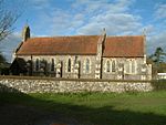
Lower Assendon
Lower Assendon is a village in the Assendon valley in the Chiltern Hills, about 1.5 miles (2.4 km) northwest of Henley-on-Thames in South Oxfordshire, England. The road between Henley and Wallingford passes the village. It was made into a turnpike in 1736 and ceased to be a turnpike in 1873. It is now classified the A4130. The village has a public house, The Golden Ball, that is now a gastropub. Henley Park is just east of the village. It was a medieval deer park and in 1300 became part of the manor of Henley. In the Georgian era the park was converted into a landscape garden with "beautiful inclosures descending in natural waving slopes from the house." Fairmile Cemetery, on a hillside southwest of the village, belongs to Henley Town Council.
Excerpt from the Wikipedia article Lower Assendon (License: CC BY-SA 3.0, Authors).Lower Assendon
Fairmile, South Oxfordshire Bix and Assendon
Geographical coordinates (GPS) Address Nearby Places Show on map
Geographical coordinates (GPS)
| Latitude | Longitude |
|---|---|
| N 51.555 ° | E -0.928 ° |
Address
Fairmile
Fairmile
RG9 6DF South Oxfordshire, Bix and Assendon
England, United Kingdom
Open on Google Maps


