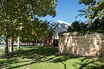
Canning River Regional Park
Canning River (Western Australia)Parks in Perth, Western AustraliaRegional parks in Western AustraliaUse Australian English from July 2018

The Canning River Regional Park is the largest of eight regional parks within the Perth metropolitan area. The park covers approximately 6 km (3.7 mi) on both sides of the Canning River between the bridges carrying Nicholson Road and Leach Highway over the Canning River. Canning River is a major tributary of the Swan River in south western Western Australia.
Excerpt from the Wikipedia article Canning River Regional Park (License: CC BY-SA 3.0, Authors, Images).Canning River Regional Park
Liege Street, City Of Canning
Geographical coordinates (GPS) Address Website External links Nearby Places Show on map
Geographical coordinates (GPS)
| Latitude | Longitude |
|---|---|
| N -32.0281 ° | E 115.9161 ° |
Address
Canning River Regional Park
Liege Street
6107 City Of Canning, Cannington
Western Australia, Australia
Open on Google Maps


