Rapperswil
1220 establishments in Europe1220s establishments in the Holy Roman Empire1450s establishments in the Holy Roman Empire1458 establishments in Europe1460s disestablishments in the Holy Roman Empire ... and 13 more
1464 disestablishments in Europe15th-century establishments in the Old Swiss Confederacy1798 disestablishments in EuropeFormer municipalities of the canton of St. GallenFormer protectorates of SwitzerlandFree imperial citiesModule:Wd reference errorsPages with Alemannic German IPAPages with plain IPAPopulated places on Lake ZurichRapperswil-JonaStates and territories established in 1220Tourist attractions in Rapperswil-Jona

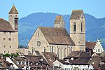
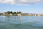
Rapperswil (Swiss German: [ˈrɑpːərʃˌʋiːl] or [ˈrɑpːərsˌʋiːl]; short: Rappi) is a former municipality and since January 2007 part of the municipality of Rapperswil-Jona in the Wahlkreis (constituency) of See-Gaster in the canton of St. Gallen in Switzerland, located between Obersee and the main part of Lake Zurich.
Excerpt from the Wikipedia article Rapperswil (License: CC BY-SA 3.0, Authors, Images).Rapperswil
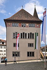
Hauptplatz, Rapperswil-Jona
Geographical coordinates (GPS) Address Nearby Places Show on map
Geographical coordinates (GPS)
| Latitude | Longitude |
|---|---|
| N 47.226666666667 ° | E 8.8166666666667 ° |
Address
Hauptplatz 15
8640 Rapperswil-Jona
St. Gallen, Switzerland
Open on Google Maps


