place

Dale Mabry Army Airfield

1940 establishments in Florida1946 disestablishments in FloridaAirfields of the United States Army Air CorpsAirfields of the United States Army Air Forces in FloridaHistory of Leon County, Florida
Transportation buildings and structures in Leon County, Florida
Dale Mabry Army Airfield 1942 Florida

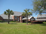
Dale Mabry Army Airfield, was a World War II United States Army Air Force located at the Dale Mabry Field airport in Tallahassee, Florida. The military airfield closed in 1946 and the airport was returned to civil use.

Excerpt from the Wikipedia article Dale Mabry Army Airfield (License: CC BY-SA 3.0, Authors, Images).

Dale Mabry Army Airfield
Appleyard Drive, Tallahassee

Geographical coordinates (GPS) Address Nearby Places
placeShow on map

Wikipedia: Dale Mabry Army AirfieldContinue reading on Wikipedia

Geographical coordinates (GPS)

Latitude Longitude
N 30.4375 ° E -84.337222222222 °
placeShow on map

Address

Appleyard Drive 235
32304 Tallahassee
Florida, United States
mapOpen on Google Maps

Dale Mabry Army Airfield 1942 Florida
Share experience

Nearby Places

Southwest Campus of Florida State University

The FSU Southwest Campus (SWC) of Florida State University (FSU) is located in Tallahassee about a mile to the southwest of the Main Campus on approximately 740 acres (3.0 km2) remaining out of a large parcel often called "The Farm", a nickname derived from a dairy farm that once operated on the site. Over the years portions of The Farm have been converted to other uses, such as housing, research, golf, mass media and academics. The Southwest campus includes the FSU Foundation and Research buildings, College of Engineering and the new Advanced Materials Research building. Two athletic complexes are found here; the Morcorm Aquatics Center and Don Veller Golf Course as well as the WFSU Public Broadcast Center (WFSU-TV and WFSU-FM). To the east and northwest, the SWC abuts residential neighborhoods. The north side adjoins and intermingles with Innovation Park, the research park of which FSU is a participant and within which FSU owns the property on which the National High Magnetic Field Laboratory is located. Orange Avenue defines the southern border and Rankin Avenue denotes the far west. Large parcels of the SWC are occupied by venerable Alumni Village on the east side, a student housing complex, the par 73, Don Veller Seminole Golf Course in the middle, and the new Intramural Fields in the northwest corner. Innovation Park was carved out of the original "Farm" property. FSU retains ownership of the parcels for the prestigious National High Magnetic Field Laboratory. Along Levy Street, FSU has begun development of a series of academic-oriented research facilities to house pure research and related centers, institutes, and technology transfer organizations.