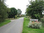
Ilmington Downs
England geography stubsGeography of WarwickshireParks and open spaces in Warwickshire

The Ilmington Downs are a large open area situated in Warwickshire, just above the small village of Ilmington. It is the highest point in Warwickshire at 858 feet with good views of that part of the Cotswolds.
Excerpt from the Wikipedia article Ilmington Downs (License: CC BY-SA 3.0, Authors, Images).Ilmington Downs
Nebsworth Lane, Stratford-on-Avon
Geographical coordinates (GPS) Address Nearby Places Show on map
Geographical coordinates (GPS)
| Latitude | Longitude |
|---|---|
| N 52.0812 ° | E -1.7113 ° |
Address
Nebsworth Lane
Nebsworth Lane
CV36 4PX Stratford-on-Avon
England, United Kingdom
Open on Google Maps


