place

Clough Head

Fells of the Lake DistrictHewitts of EnglandNuttalls
HighRigg StJohnsVale

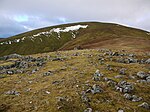
Clough Head ( ) (meaning: hill-top above the ravine) is a fell, or hill, in the English Lake District. It marks the northern end of the main ridge of the Helvellyn range and is often walked as part of the ridge walk. The fell stands south of the village of Threlkeld and the A66 road, and it forms the steep eastern side of the tranquil valley of St John's in the Vale. On its western side the fell displays a dark mass of rocky crags and a deep-set rocky ravine. On the other side it has smooth grassy slopes. Beneath the north face is the steep valley or clough from which Clough Head gets its name. Also beneath the steep northern face lies the lower hill of Threlkeld Knotts, a granite hill which has been much quarried round its margin. A number of different types of rock are found on and around Clough Head, which were formed in very different circumstances. These include deep-sea sedimentation, effusive volcanic lava flows, explosive volcanism, an intrusion of granite, mineralisation and finally glacial sculpting. To understand the geology of Clough Head is to understand much of the geology of the Lake District. An old route known as the Old Coach Road passes beneath Clough Head. Most of the fell is Open Access land, which walkers can enter from either end of the Old Coach Road, or from a lane south of the village of Threlkeld. Four main routes lead to the summit.

Excerpt from the Wikipedia article Clough Head (License: CC BY-SA 3.0, Authors, Images).

Geographical coordinates (GPS)

Latitude Longitude
N 54.59326 ° E -3.03379 °
placeShow on map

Address

Clough Fold


CA12 4TX , St. John's Castlerigg and Wythburn
England, United Kingdom
mapOpen on Google Maps

HighRigg StJohnsVale
Share experience

Nearby Places

St John's in the Vale

St John’s in the Vale is a glacial valley in the Lake District National Park, Cumbria, England. Within the vale are a number of farms and small settlements, in addition to several disused quarry and mining works. St John’s Beck meanders northward along the floor of the vale, and is the main outflow from Thirlmere reservoir, which is located to the south. Alongside the beck runs the B5322, St John’s in the Vale Road. The vale is in the heart of the northern Lake District and is surrounded by many of the most striking of the Lakeland fells. It runs from south to north, set between the rocky flanks of Clough Head to the east and the neighbours High Rigg and Low Rigg to the west. The southern end of the vale is a narrow pass between High Rigg and Great Dodd, just to the north of the small settlement of Legburthwaite. At its northern end the vale widens to meet the broad east-to-west valley of the River Greta near Threlkeld. The view north from the vale is dominated by the mountains Blencathra and Skiddaw. High on the western side of the vale lies St John’s in the Vale Church, located in a low pass between High Rigg on the southern side and Low Rigg to the north. This pass provides access for suitably capable vehicles between the vale and Dale Bottom in the Naddle Valley to the west of High Rigg. The present building dates from 1845, with the earliest reference to a church at the site being 1554. On the opposite side of the vale, cut into the northern flank of Clough Head, lies the Threlkeld Quarry and Mining Museum. This former commercial quarry, first opened in the late nineteenth century, was established as a museum in 1992. The picturesque writer William Gilpin describes a landslide that happened here on 22 August 1749 as being caused by ‘one of those terrible inundations, which wasted lately the vale of Brackenwait’.