place

Great Dodd

Fells of the Lake DistrictHewitts of EnglandNuttalls
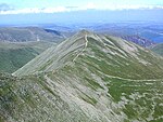
Great Dodd from Randerside

Great Dodd (meaning: big round hill) is a mountain or fell in the English Lake District. It stands on the main ridge of the Helvellyn range, a line of mountains which runs in a north–south direction between the lakes of Thirlmere and Ullswater in the east of the Lake District. Great Dodd, with a height of 857 metres (2,812 ft) is the highest of the fells in this range to the north of Sticks Pass. Walkers may approach Great Dodd from either High Row near Dockray to the east, or from Legburthwaite to the west – or along the main ridge track from either north or south. Scramblers with climbing skills may be attracted to three gill climbs on the western side of the mountain. The summit of Great Dodd is a smooth, grassy, rounded dome, like its two southern neighbours, Watson's Dodd and Stybarrow Dodd. Together, these three are sometimes called ‘The Three Dodds’. These three are made of volcanic rocks of the Borrowdale Volcanic Group, and the tops of all three are covered by the same sheet of rock, which was formed in a series of huge volcanic explosions accompanying the formation of a volcanic caldera about 450 million years ago. Two attempts were made to mine mineral veins in the rocks of Great Dodd, but neither attempt was successful.

Excerpt from the Wikipedia article Great Dodd (License: CC BY-SA 3.0, Authors, Images).

Geographical coordinates (GPS)

Latitude Longitude
N 54.57541 ° E -3.01941 °
placeShow on map

Address

Mill Gill Head


CA12 4TS , St. John's Castlerigg and Wythburn
England, United Kingdom
mapOpen on Google Maps

Great Dodd from Randerside
Share experience

Nearby Places

St John's in the Vale

St John’s in the Vale is a glacial valley in the Lake District National Park, Cumbria, England. Within the vale are a number of farms and small settlements, in addition to several disused quarry and mining works. St John’s Beck meanders northward along the floor of the vale, and is the main outflow from Thirlmere reservoir, which is located to the south. Alongside the beck runs the B5322, St John’s in the Vale Road. The vale is in the heart of the northern Lake District and is surrounded by many of the most striking of the Lakeland fells. It runs from south to north, set between the rocky flanks of Clough Head to the east and the neighbours High Rigg and Low Rigg to the west. The southern end of the vale is a narrow pass between High Rigg and Great Dodd, just to the north of the small settlement of Legburthwaite. At its northern end the vale widens to meet the broad east-to-west valley of the River Greta near Threlkeld. The view north from the vale is dominated by the mountains Blencathra and Skiddaw. High on the western side of the vale lies St John’s in the Vale Church, located in a low pass between High Rigg on the southern side and Low Rigg to the north. This pass provides access for suitably capable vehicles between the vale and Dale Bottom in the Naddle Valley to the west of High Rigg. The present building dates from 1845, with the earliest reference to a church at the site being 1554. On the opposite side of the vale, cut into the northern flank of Clough Head, lies the Threlkeld Quarry and Mining Museum. This former commercial quarry, first opened in the late nineteenth century, was established as a museum in 1992. The picturesque writer William Gilpin describes a landslide that happened here on 22 August 1749 as being caused by ‘one of those terrible inundations, which wasted lately the vale of Brackenwait’.

Greenside Mine
Greenside Mine

Greenside Mine (sometimes referred to as Greenside Lead Mine) was a successful lead mine in the Lake District of England. Between 1825 and 1961 the mine produced 156,000 long tons (159,000 tonnes) of lead and 1,600,000 ounces (45 tonnes) of silver, from around 2 million tons of ore. During the 1940s it was the largest producer of lead ore in the UK. Unusually for a 19th-century metalliferous mine in Britain there are very full records of its activities, dating back to 1825. The mine probably opened during the second half of the 1700s but had closed by 1819. In 1825 the Greenside Mining Company was formed and reopened the mine. They made good profits until 1880, when the price of lead fell. Many other lead mines closed at that time, but the company reduced its costs and continued to work Greenside until 1935. Electricity was introduced to the mine in the 1890s, and it became the first metalliferous mine in Britain to use electric winding engines and an electric locomotive. In 1936 the Basinghall Mining Syndicate Ltd. acquired the mine and turned it into a high volume lead producer. The mine closed in 1962 after lead reserves had been exhausted. Just before it closed the mine was used by the Atomic Weapons Research Establishment (AWRE) to conduct an experiment in detecting seismic signals from underground explosions. Fifteen years after the mine closed mine explorers began to visit the upper levels. They cleared the entrances and several roof falls, and today they are able to pass through the mine using an old escape route. All the ore produced by the mine came from the Greenside Vein, a mineral vein which filled a geological fault running in a north–south direction through the east ridge of Green Side, a mountain in the Helvellyn range. Mining activities traced this fault for a length of 3,900 feet (1,200 m) and to a depth of 2,900 feet (880 m). Four areas of the vein, known as ore shoots, contained galena, an ore of lead which also contained small amounts of silver. At first the ore was mined simply by driving adits into the mountain-side. To access ore at greater depths, two longer levels were driven from lower down but further away, and then a series of shafts were sunk within the mine. The lowest point in the mine was roughly 100 m below sea level, where the surrounding andesite rock rested upon underlying shales in which the fault had not been mineralised. Two processing mills were built to crush the ore and separate out the galena from it, and the mine had its own smelt mill between 1828 and 1917, but after that it was more economical to sell concentrated galena to a commercial smelter. Machinery in the mine and the mills was powered by the plentiful water supplies in the area, used to drive water wheels and power hydraulic engines, and, after 1890, to generate hydroelectricity. Dozens of carts transported supplies to the mine's remote location, and carried the lead out. In the early 1900s the mine set up its own road haulage business using two steam wagons. The men who worked at the mine during the 19th century travelled from a wide area, and many stayed each week in the lodging shops (bunkhouses) built at the mine. In time the company built dozens of houses in Glenridding and at Seldom Seen in Glencoynedale where a school was also built. Mining work was carried out by groups of men who took contracts to do specific jobs, and were paid by their results. Those who worked transporting ore out of the mine or processing the ore were paid at weekly rates. The closure of the mine resulted in a major loss of employment in the area.