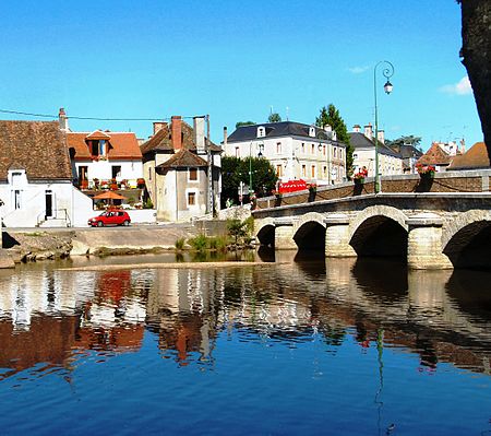
Benaize
Creuse geography stubsFrance river stubsHaute-Vienne geography stubsIndre geography stubsPages with French IPA ... and 9 more
Rivers of Centre-Val de LoireRivers of CreuseRivers of FranceRivers of Haute-VienneRivers of IndreRivers of Nouvelle-AquitaineRivers of VienneTributaries of the CreuseVienne geography stubs

The Benaize (French pronunciation: [bənɛz]; Occitan: Benesa, Beneisa or Benaisa) is a 79-kilometre (49 mi) long river in the Creuse, Haute-Vienne, Vienne and Indre departments, central France. Its source is near La Souterraine. It flows generally northwest. It is a left tributary of the Anglin, into which it flows north of Saint-Hilaire-sur-Benaize.
Excerpt from the Wikipedia article Benaize (License: CC BY-SA 3.0, Authors, Images).Benaize
Chemin Rural, Le Blanc
Geographical coordinates (GPS) Address Nearby Places Show on map
Geographical coordinates (GPS)
| Latitude | Longitude |
|---|---|
| N 46.573888888889 ° | E 1.0683333333333 ° |
Address
Chemin Rural
Chemin Rural
36370 Le Blanc
Centre-Val de Loire, France
Open on Google Maps


