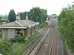
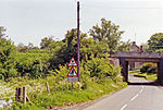
Clifton, Oxfordshire
Cherwell DistrictOxfordshire geography stubsUse British English from September 2014Villages in Oxfordshire
Clifton is a hamlet by the River Cherwell in Deddington civil parish about 6 miles (10 km) south of Banbury, Oxfordshire, England. Clifton is on the B4031 road between Deddington and Croughton, Northamptonshire.
Excerpt from the Wikipedia article Clifton, Oxfordshire (License: CC BY-SA 3.0, Authors).Clifton, Oxfordshire
B4031, Cherwell District
Geographical coordinates (GPS) Address Nearby Places Show on map
Geographical coordinates (GPS)
| Latitude | Longitude |
|---|---|
| N 51.983 ° | E -1.289 ° |
Address
B4031
OX15 0PD Cherwell District
England, United Kingdom
Open on Google Maps


